Download
Preview
Add to list
More
567.8 km
~29 days
6279 m
Multi-Day
“Embark on the Sheltowee Trace Trail for an immersive Appalachian adventure through Kentucky's historical and natural splendors.”
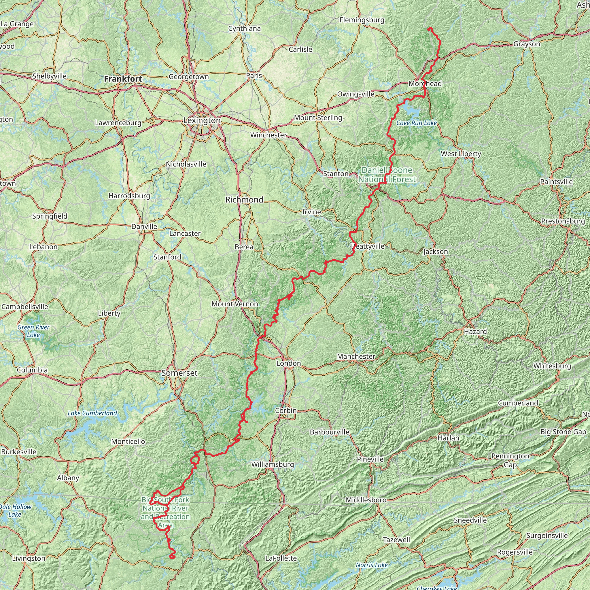
Spanning approximately 568 kilometers (353 miles) and with an elevation gain of around 6200 meters (20,341 feet), the Sheltowee Trace Trail is a remarkable journey through the heart of the Appalachian region. Starting near Rowan County, Kentucky, this point-to-point trail offers a medium difficulty rating, making it accessible to hikers with a reasonable level of fitness and experience.Getting to the TrailheadTo reach the trailhead, hikers can drive to Morehead, Kentucky, which is the nearest town to the northern terminus of the Sheltowee Trace Trail. From Morehead, the trailhead is just a short distance away, located near the Daniel Boone National Forest boundary. For those relying on public transportation, options may be limited, but regional bus services can get you to Morehead, where you may need to arrange a taxi or a shuttle service to the trailhead.Navigating the TrailHikers can utilize the HiiKER app for detailed maps and navigation assistance throughout their trek. The app provides up-to-date trail information, helping to ensure a safe and enjoyable experience.Trail Highlights and LandmarksAs you embark on the Sheltowee Trace Trail, you'll traverse a diverse landscape of rolling hills, dense forests, and clear streams. The trail is named after Daniel Boone, the famous frontiersman, and "Sheltowee" was his given Shawnee name, meaning "Big Turtle."The trail passes through several natural areas of note, including the Red River Gorge Geological Area, known for its stunning rock formations and arches. Approximately 64 kilometers (40 miles) into the hike, you'll encounter the iconic Natural Bridge, a massive sandstone arch that spans nearly 23 meters (75 feet) and is a highlight for many hikers.Further along, the Cumberland Falls State Resort Park presents the "Niagara of the South," Cumberland Falls, a breathtaking waterfall that spans 38 meters (125 feet) and is known for its moonbow, a rare lunar rainbow visible on clear, moonlit nights.Flora and FaunaThe trail offers an opportunity to witness the rich biodiversity of the region. Hikers will walk through forests of hemlock, oak, and hickory, and during the spring, the wildflowers, including trilliums and wild orchids, are a spectacular sight. Wildlife is abundant, with chances to spot white-tailed deer, black bears, and a variety of bird species, such as the pileated woodpecker and the Kentucky warbler.Historical SignificanceThe Sheltowee Trace Trail winds through areas steeped in history. It crosses paths with pioneer routes and Native American trails that have been used for centuries. The trail also intersects with historical landmarks from the Civil War, offering a tangible connection to the past.Preparation and PlanningHikers should prepare for variable weather conditions and pack accordingly. Water sources are available along the trail, but purification is recommended. It's also wise to plan for food resupply points, as the trail crosses several roads and small towns where provisions can be obtained.Safety and EtiquetteAlways practice Leave No Trace principles to minimize your impact on the environment. Be prepared for backcountry conditions, carry a first aid kit, and let someone know your itinerary. Cell service can be spotty, so plan for periods without coverage.By respecting the trail and its surroundings, hikers can ensure that the Sheltowee Trace Trail remains a cherished path for future adventurers to experience the natural beauty and historical richness of Kentucky's wilderness.
What to expect?
Activity types
Comments and Reviews
User comments, reviews and discussions about the Sheltowee Trace Trail, Kentucky.
4.75
average rating out of 5
16 rating(s)

