Download
3D Flyover
Add to list
More
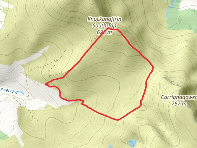
7.2 km
~2 hrs 29 min
630 m
Loop
“Cradled by ancient cliffs and wild heather, this loop unveils Coumshingaun’s legendary amphitheatre and breathtaking vistas.”
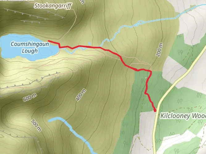
Starting from the small car park near Kilclooney Wood, just outside the village of Rathgormack in County Waterford, the Coumshingaun Lough Loop is a striking 7 km (about 4.3 miles) circuit with a challenging 600 metres (nearly 2,000 feet) of elevation gain. The trailhead is easily accessible by car, with parking available at the forest entrance. For those using public transport, buses from Waterford city serve Carrick-on-Suir, from where a taxi or local link service can bring you to Rathgormack; the trailhead is a short drive from there.
Initial Ascent and Lough Views
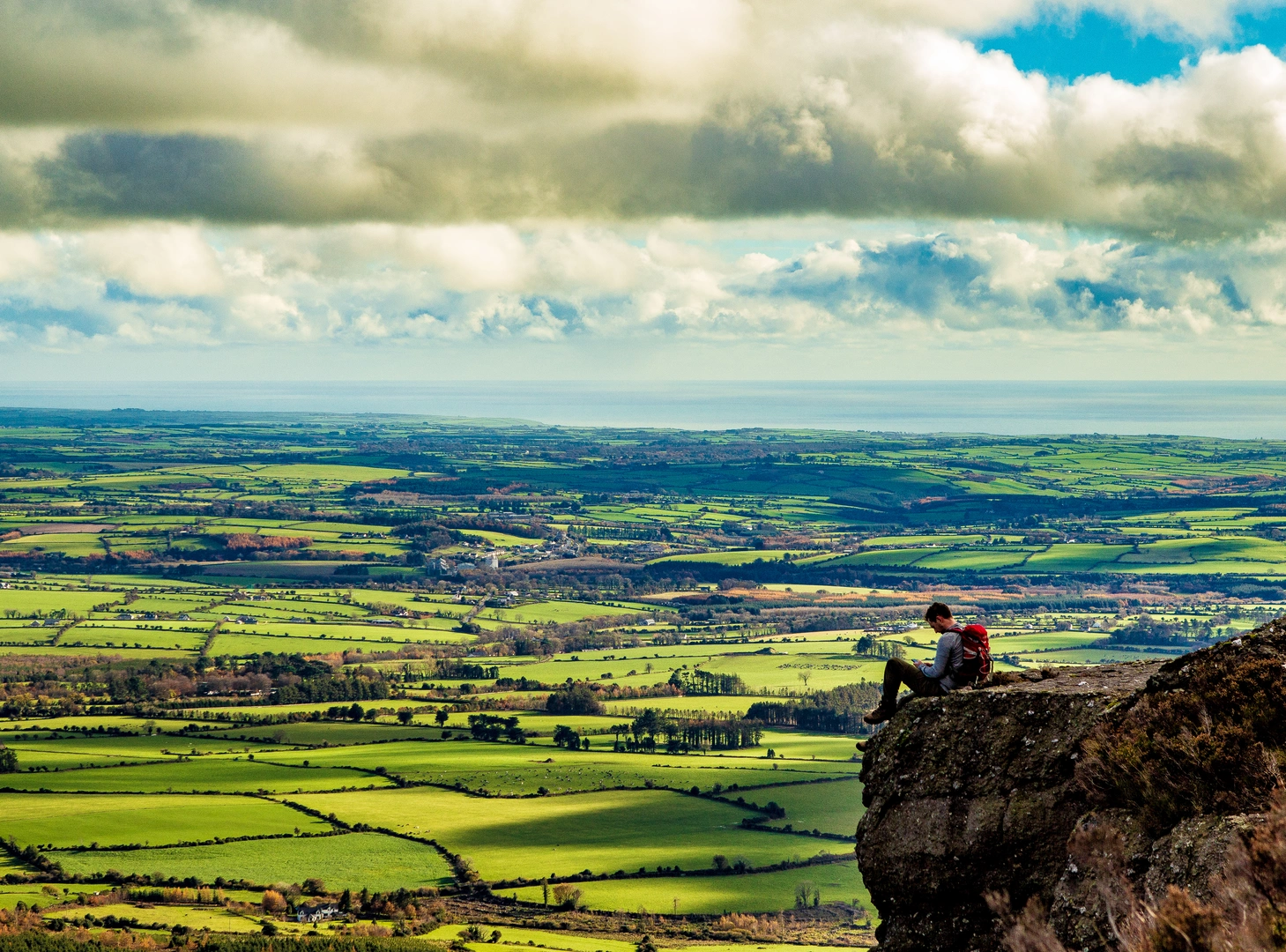
The route begins with a gentle forest track, quickly giving way to open hillside as you leave the shelter of Kilclooney Wood. The climb steepens as you ascend the shoulder of the Comeragh Mountains, with the path becoming rocky and sometimes boggy—waterproof boots are essential. After about 1.5 km (just under a mile), the landscape opens up, revealing the dramatic glacial corrie of Coumshingaun Lough below. The lough itself is a near-perfect amphitheatre, carved by ice over thousands of years, and is one of Ireland’s most iconic natural features.
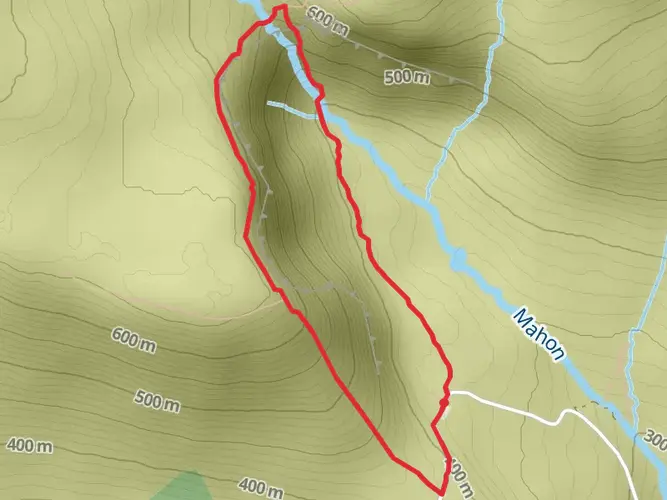
Ridge Walk and Panoramic Vistas
The loop continues along the high rim of the corrie, where the path narrows and the drop to the lough below becomes more pronounced. This section, roughly 3 km (1.9 miles) in, is exposed and can be windy—layers and windproof clothing are recommended. The ridge offers sweeping views across County Waterford and, on clear days, as far as the Celtic Sea. The cliffs here are home to ravens, peregrine falcons, and mountain goats, while the heather and bog cotton add splashes of color in late summer.
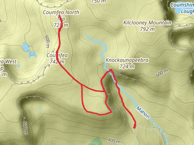
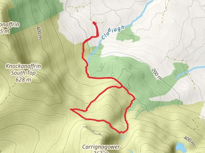
Descent and Return
After circling the lough, the descent is steep and can be slippery, especially after rain. Trekking poles are helpful for stability. The path winds back down through rough grassland and eventually rejoins the forest track, completing the loop at the starting point. The total elevation gain is significant, so allow 3–4 hours for the full circuit, depending on pace and weather conditions.
Navigation and Safety
Weather in the Comeraghs can change rapidly, with mist and fog common even in summer. Carry a map and compass, and use HiiKER for up-to-date trail navigation and route tracking. Mobile signal can be patchy on the higher sections, so download maps in advance. There are no facilities on the trail, so bring sufficient water and food.
Historical and Natural Significance
The Comeragh Mountains are steeped in legend, with Coumshingaun Lough often cited in local folklore as a place of mystery and enchantment. The glacial origins of the lough are evident in the sheer cliffs and boulder-strewn slopes, while the surrounding uplands have been grazed by sheep for centuries. The area is part of a Special Area of Conservation, protecting its unique flora and fauna.
Prepare for rapidly changing conditions, and always let someone know your plans before setting out. The Coumshingaun Lough Loop is a demanding but rewarding hike, offering some of the most spectacular mountain scenery in Ireland.

What to expect?
Activity types
Comments and Reviews
User comments, reviews and discussions about the Coumshingaun Lough Loop, Ireland.
4.87
average rating out of 5
171 rating(s)