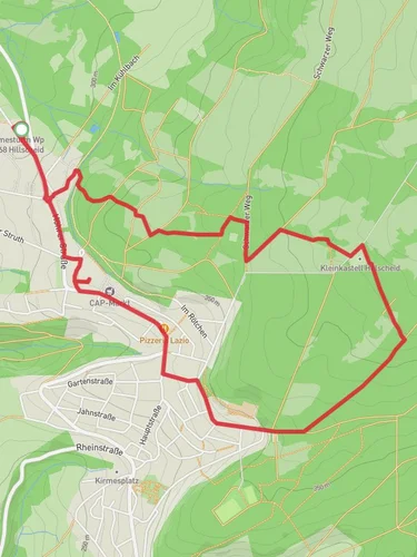
11.6 km
~2 hrs 30 min
123 m
“Immerse in the serene beauty of Westerwald on the 12 km Erlenhofsee via Koeppelweg trail.”
Starting your hike near Westerwaldkreis, Germany, the Erlenhofsee via Koeppelweg trail offers a delightful 12 km (7.5 miles) loop with an elevation gain of approximately 100 meters (328 feet). This medium-difficulty trail is perfect for those looking to immerse themselves in the serene beauty of the Westerwald region.
### Getting There To reach the trailhead, you can drive or use public transport. If driving, set your GPS to the nearest known address: Westerwaldkreis, Germany. For those using public transport, take a train to Montabaur station, which is well-connected to major cities like Frankfurt and Cologne. From Montabaur, you can catch a local bus or taxi to the trailhead.
### Trail Overview The trail begins near the picturesque Erlenhofsee, a small lake surrounded by lush greenery. As you start your hike, you'll be greeted by a well-marked path that meanders through dense forests and open meadows. The initial section is relatively flat, making it an excellent warm-up for the more challenging parts ahead.
### Key Landmarks and Points of Interest - Erlenhofsee: At the very start, take a moment to enjoy the tranquil waters of Erlenhofsee. It's a great spot for bird-watching, with various species often seen around the lake. - Koeppelweg: As you continue, you'll join the Koeppelweg, a historic path that has been used for centuries. This section of the trail offers a gentle ascent, providing panoramic views of the surrounding countryside. - Westerwald Forest: About 4 km (2.5 miles) into the hike, you'll enter the dense Westerwald Forest. This area is rich in biodiversity, home to deer, foxes, and a variety of bird species. Keep an eye out for the rare black woodpecker. - Historical Significance: The Westerwald region has a rich history dating back to the Roman era. Along the trail, you'll find remnants of ancient Roman roads and possibly even some old boundary stones. These historical markers offer a glimpse into the past and add an educational element to your hike.
### Navigation and Safety The trail is well-marked, but it's always a good idea to have a reliable navigation tool. Use HiiKER to download the trail map and keep track of your progress. The app will help you stay on course and provide real-time updates on your location.
### Flora and Fauna The trail is a haven for nature enthusiasts. In spring and summer, the meadows are adorned with wildflowers, including orchids and lilies. The forested sections are dominated by oak, beech, and pine trees, providing ample shade and a cool respite during warmer months.
### Elevation and Terrain The total elevation gain is around 100 meters (328 feet), spread out over the 12 km (7.5 miles) loop. The terrain varies from flat sections near the lake to gentle inclines and a few steeper parts as you navigate through the forest. Good hiking boots are recommended to handle the mixed terrain comfortably.
### Practical Tips - Water and Snacks: There are no facilities along the trail, so bring enough water and snacks to keep you energized. - Weather: Check the weather forecast before heading out. The trail can get muddy after rain, making some sections slippery. - Wildlife: While encounters with wildlife are generally safe, it's always best to observe animals from a distance and avoid feeding them.
By following these guidelines and being well-prepared, you'll have a memorable and enjoyable hike on the Erlenhofsee via Koeppelweg trail.
Reviews
User comments, reviews and discussions about the Erlenhofsee via Koeppelweg, Germany.
4.0
average rating out of 5
1 rating(s)


