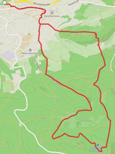
13.1 km
~3 hrs 17 min
411 m
“Explore lush forests, historic castles, and stunning rock formations on the captivating Bertrada Route and Felsenweg Loop.”
Starting near the picturesque village of Mürlenbach in the Vulkaneifel region of Germany, the Bertrada Route and Felsenweg Loop is a captivating 13 km (8 miles) trail with an elevation gain of approximately 400 meters (1,312 feet). This loop trail is rated as medium difficulty, making it suitable for moderately experienced hikers.
### Getting There To reach the trailhead, you can drive to Mürlenbach, which is accessible via the B410 road. For those using public transport, the nearest train station is in Mürlenbach itself, which is well-connected to larger cities like Cologne and Trier. From the station, it's a short walk to the trailhead.
### Trail Highlights and Landmarks The trail begins near the historic Bertradaburg Castle, a medieval fortress that dates back to the 9th century. This castle is named after Bertrada of Laon, the mother of Charlemagne, adding a rich historical context to your hike. As you start your journey, you'll be greeted by the lush greenery of the Vulkaneifel region, known for its volcanic origins and unique geological formations.
### Nature and Wildlife As you progress along the trail, you'll traverse through dense forests and open meadows, offering a diverse range of flora and fauna. Keep an eye out for native wildlife such as deer, foxes, and a variety of bird species. The trail is particularly beautiful in spring and autumn when the foliage is either in full bloom or displaying vibrant fall colors.
### Felsenweg Section Around the 5 km (3.1 miles) mark, you'll reach the Felsenweg section, known for its impressive rock formations. This part of the trail offers some of the most stunning views of the surrounding landscape. The rocky outcrops provide excellent vantage points for photography, so make sure to bring your camera.
### Elevation and Terrain The trail features a mix of ascents and descents, with the most significant climb occurring around the 7 km (4.3 miles) point. Here, you'll gain approximately 200 meters (656 feet) in elevation over a relatively short distance, so be prepared for a bit of a workout. The terrain varies from well-maintained paths to more rugged sections, so sturdy hiking boots are recommended.
### Navigation To ensure you stay on track, it's advisable to use the HiiKER app, which provides detailed maps and real-time navigation. The trail is well-marked, but having a reliable navigation tool can enhance your hiking experience and provide peace of mind.
### Historical Significance The Vulkaneifel region is steeped in history, with evidence of human settlement dating back to Roman times. The volcanic landscape has shaped not only the geography but also the culture and history of the area. As you hike, you'll come across several informational plaques that provide insights into the region's geological and historical background.
### Final Stretch As you near the end of the loop, you'll descend back towards Mürlenbach, passing through serene woodlands and along the banks of the Kyll River. The final 2 km (1.2 miles) are relatively flat, allowing you to cool down and reflect on the diverse landscapes and historical landmarks you've encountered.
This trail offers a perfect blend of natural beauty, physical challenge, and historical intrigue, making it a must-visit for any hiking enthusiast exploring the Vulkaneifel region.
Reviews
User comments, reviews and discussions about the Bertrada Route and Felsenweg Loop - Mürlenbach to Birresborn, Germany.
0.0
average rating out of 5
0 rating(s)


