6.5 km
~1 hrs 55 min
375 m
“Embark on the enchanting Rundwanderweg PWV 15 for a scenic blend of nature, history, and local charm.”
Starting near the charming region of Südliche Weinstraße in Germany, the Rundwanderweg PWV 15 is a delightful loop trail that spans approximately 7 kilometers (4.35 miles) with an elevation gain of around 300 meters (984 feet). This medium-difficulty trail offers a blend of natural beauty, historical landmarks, and a touch of local culture, making it a rewarding experience for hikers.
### Getting There To reach the trailhead, you can either drive or use public transport. If you’re driving, head towards the Südliche Weinstraße district, where ample parking is available near the starting point. For those using public transport, the nearest significant landmark is the town of Bad Bergzabern. From there, local buses can take you closer to the trailhead.
### Trail Navigation For navigation, it’s highly recommended to use the HiiKER app, which provides detailed maps and real-time updates to ensure you stay on track throughout your hike.
### Trail Highlights As you embark on the Rundwanderweg PWV 15, you’ll be greeted by a variety of landscapes, from dense forests to open meadows. The trail is well-marked, making it easy to follow, but always keep an eye on your HiiKER app for any updates or changes.
#### Nature and Wildlife The trail is a haven for nature enthusiasts. You’ll traverse through sections of lush forest, where you might spot local wildlife such as deer, foxes, and a variety of bird species. The flora is equally impressive, with seasonal wildflowers adding a splash of color to the verdant surroundings.
#### Historical Significance One of the notable aspects of this trail is its historical significance. The Südliche Weinstraße region is steeped in history, with remnants of ancient Roman settlements and medieval castles dotting the landscape. Approximately 3 kilometers (1.86 miles) into the hike, you’ll come across the ruins of an old castle, offering a glimpse into the region’s storied past. This spot also provides a great vantage point for panoramic views of the surrounding countryside.
### Elevation and Terrain The trail’s elevation gain of 300 meters (984 feet) is spread out over the 7 kilometers (4.35 miles), making it a manageable climb for most hikers. The terrain varies from gentle slopes to more challenging inclines, so be prepared for a bit of a workout. Good hiking boots are recommended to navigate the sometimes rocky and uneven paths.
### Points of Interest Around the halfway mark, you’ll find a picturesque clearing perfect for a rest stop. Here, you can enjoy a packed lunch while taking in the serene views. There are also several informational plaques along the trail that provide insights into the local flora, fauna, and history, enriching your hiking experience.
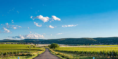
### Final Stretch As you loop back towards the starting point, the trail descends gently, offering a relaxing end to your hike. The final stretch takes you through a beautiful vineyard, a nod to the region’s renowned wine production. If you have time, consider visiting one of the local wineries for a tasting session after your hike.
### Preparation Tips Ensure you carry enough water, especially during the warmer months, and pack some snacks to keep your energy levels up. Weather can be unpredictable, so check the forecast and dress in layers. A lightweight rain jacket might come in handy.
By following these guidelines and using the HiiKER app for navigation, you’ll be well-prepared to enjoy the Rundwanderweg PWV 15 and all the natural and historical wonders it has to offer.

Reviews
User comments, reviews and discussions about the Rundwanderweg PWV 15, Germany.
0.0
average rating out of 5
0 rating(s)