5.1 km
~1 hrs 11 min
105 m
“Discover the Höllenbach and Friedrich Rückert Wanderweg: a 5 km hike blending natural beauty with historical charm.”
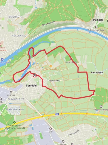
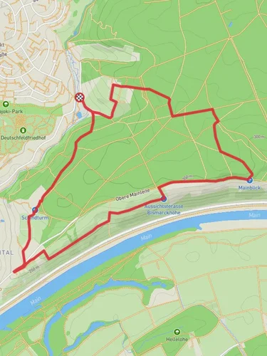
Starting near Schweinfurt, Germany, the Höllenbach and Friedrich Rueckert Wanderweg is a delightful 5 km (3.1 miles) loop trail with an elevation gain of approximately 100 meters (328 feet). This trail offers a medium difficulty rating, making it suitable for moderately experienced hikers.
### Getting There
To reach the trailhead, you can either drive or use public transport. If driving, head towards Schweinfurt and look for parking near the outskirts of the town, close to the trail's starting point. For those using public transport, Schweinfurt is well-connected by train and bus services. From the Schweinfurt Hauptbahnhof (main train station), you can take a local bus to the nearest stop, which is a short walk from the trailhead.
### Trail Highlights
#### Historical Significance
The trail is named after Friedrich Rückert, a renowned German poet and translator born in Schweinfurt. As you hike, you'll encounter several plaques and markers that provide insights into Rückert's life and works. These historical markers are a great way to immerse yourself in the cultural heritage of the region.
#### Natural Beauty
The trail meanders through a mix of dense forests and open meadows, offering a variety of landscapes. Early in the hike, you'll cross the Höllenbach stream, a serene spot perfect for a brief pause to enjoy the sound of flowing water. The forested sections are rich with native flora, including oak and beech trees, and in the spring, the ground is often carpeted with wildflowers.
#### Wildlife
Keep an eye out for local wildlife, including deer, foxes, and a variety of bird species. The forested areas provide excellent bird-watching opportunities, so bringing a pair of binoculars could enhance your experience.
### Navigation and Waypoints
Using HiiKER for navigation is highly recommended. The app provides detailed maps and real-time GPS tracking, ensuring you stay on the correct path. Key waypoints to look out for include:
- 0.5 km (0.3 miles): The Höllenbach stream crossing. - 2 km (1.2 miles): A viewpoint offering panoramic views of the surrounding countryside. - 3.5 km (2.2 miles): A small clearing with benches, ideal for a rest stop.
### Elevation Profile
The trail features a gentle ascent of about 100 meters (328 feet), spread evenly throughout the hike. The initial part of the trail is relatively flat, making it a good warm-up before you start the gradual climb. The highest point of the trail offers a rewarding view, making the effort worthwhile.
### Practical Tips
- Footwear: Sturdy hiking boots are recommended due to uneven terrain and potential muddy sections, especially after rain. - Weather: Check the weather forecast before heading out. The trail can become slippery in wet conditions. - Supplies: Carry enough water and snacks, as there are no facilities along the trail. - Safety: Always inform someone of your hiking plans and expected return time.
This trail offers a perfect blend of natural beauty, historical significance, and moderate physical challenge, making it a rewarding experience for those who venture out to explore it.
Reviews
User comments, reviews and discussions about the Höllenbach and Friedrich Rueckert Wanderweg, Germany.
5.0
average rating out of 5
5 rating(s)


