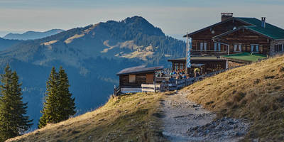
Scharspitze and Kohlhaukuppe via Gelber Punkt
10.5 km
~2 hrs 33 min
275 m
“Embark on an 11 km scenic loop through Sächsische Schweiz-Osterzgebirge, rich in nature and history.”
Starting your adventure near the picturesque region of Sächsische Schweiz-Osterzgebirge in Germany, the Scharspitze and Kohlhaukuppe via Gelber Punkt trail offers a delightful loop of around 11 km (approximately 6.8 miles) with an elevation gain of about 200 meters (656 feet). This medium-difficulty trail is perfect for those looking to immerse themselves in the natural beauty and historical richness of the area.
### Getting There To reach the trailhead, you can either drive or use public transport. If you're driving, set your GPS to the nearest known address, which is close to the town of Altenberg. For those using public transport, take a train to Altenberg station and then a local bus or taxi to the trailhead.
### Trail Overview The trail begins with a gentle ascent, allowing you to ease into the hike. As you progress, you'll encounter a mix of forested paths and open meadows, providing a variety of landscapes to enjoy. The initial part of the trail is well-marked with yellow dots, guiding you through the dense forest.
### Significant Landmarks - Scharspitze: At approximately 3 km (1.86 miles) into the hike, you'll reach Scharspitze. This peak offers stunning panoramic views of the surrounding countryside. It's a great spot to take a break and soak in the scenery. - Kohlhaukuppe: Continuing on, around the 7 km (4.35 miles) mark, you'll arrive at Kohlhaukuppe. This area is known for its historical significance, as it was a strategic lookout point during various historical conflicts. The summit provides another excellent vantage point for breathtaking views.
### Flora and Fauna The trail is rich in biodiversity. Keep an eye out for native wildlife such as deer, foxes, and a variety of bird species. The forested sections are home to ancient beech and oak trees, while the meadows are dotted with wildflowers, especially vibrant in the spring and summer months.
### Historical Significance The region has a deep historical background, with remnants of old fortifications and lookout points. During your hike, you'll come across several informational plaques detailing the area's history, including its role in regional conflicts and its significance in local folklore.
### Navigation and Safety For navigation, it's highly recommended to use the HiiKER app, which provides detailed maps and real-time updates. The trail is generally well-marked, but having a reliable navigation tool will ensure you stay on track.
### Final Stretch The last few kilometers of the trail loop back towards the starting point, descending gently through a mix of forest and open fields. This section is relatively easy, allowing you to cool down and reflect on the hike.
### Practical Tips - Footwear: Sturdy hiking boots are recommended due to the varied terrain. - Weather: Check the weather forecast before you go, as conditions can change rapidly. - Supplies: Bring enough water and snacks, as there are limited facilities along the trail. - Timing: Allocate around 4-5 hours to complete the hike, allowing time for breaks and photo opportunities.
Embark on this trail to experience the natural beauty and historical depth of the Sächsische Schweiz-Osterzgebirge region.
Reviews
User comments, reviews and discussions about the Scharspitze and Kohlhaukuppe via Gelber Punkt, Germany.
4.0
average rating out of 5
3 rating(s)


