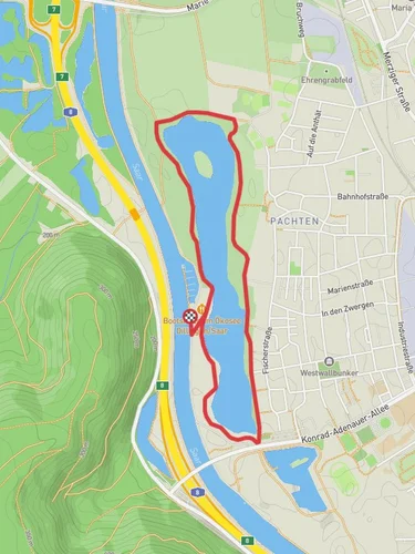
10.8 km
~2 hrs 34 min
246 m
“Explore the diverse landscapes and historical intrigue of the 11 km Gallenberg, Husterheck, and Hasen Loop.”
Starting near Saarlouis, Germany, the Gallenberg, Husterheck, and Hasen Loop is an 11 km (approximately 6.8 miles) trail with an elevation gain of around 200 meters (656 feet). This loop trail is rated as medium difficulty, making it suitable for hikers with some experience.
### Getting There To reach the trailhead, you can drive or use public transport. If driving, set your GPS to Saarlouis, and look for parking options near the trailhead. For those using public transport, Saarlouis is well-connected by train and bus services. From the Saarlouis Hauptbahnhof (main train station), you can take a local bus or taxi to the trailhead.
### Trail Overview The trail begins with a gentle ascent, allowing you to ease into the hike. As you progress, you'll encounter a mix of forested areas and open landscapes, providing a variety of scenery. The initial part of the trail takes you through dense woods, where you might spot local wildlife such as deer and various bird species.
### Key Landmarks and Sections
#### Gallenberg Around the 3 km (1.86 miles) mark, you'll reach the Gallenberg section. This area is known for its lush greenery and offers a moderate climb. The elevation gain here is about 50 meters (164 feet), making it a good warm-up for the rest of the hike. Keep an eye out for wildflowers and small streams that add to the natural beauty.
#### Husterheck At approximately 6 km (3.73 miles), you'll enter the Husterheck area. This section is slightly more challenging, with an elevation gain of around 100 meters (328 feet). The trail here is well-marked but can be narrow and rocky in places, so good hiking boots are recommended. Husterheck is also home to some historical remnants, including old boundary stones that date back to the 18th century, offering a glimpse into the region's past.
#### Hasen The final section, Hasen, comes around the 9 km (5.59 miles) mark. This part of the trail is relatively flat, making for a pleasant end to your hike. The area is known for its open meadows and panoramic views of the surrounding countryside. It's a great spot to take a break and enjoy a picnic if you’ve packed one.
### Navigation and Safety Given the varied terrain and forested areas, it's advisable to use a reliable navigation tool like HiiKER to stay on track. The trail is generally well-marked, but having a digital map can be very helpful, especially in the more remote sections.
### Flora and Fauna Throughout the hike, you'll encounter a diverse range of flora and fauna. The forested areas are home to oak, beech, and pine trees, while the open meadows feature a variety of wildflowers. Wildlife sightings can include deer, foxes, and numerous bird species, making it a rewarding experience for nature enthusiasts.
### Historical Significance The region around Saarlouis has a rich history, with Saarlouis itself being a fortress town founded by Louis XIV of France in the 17th century. While the trail itself is more focused on natural beauty, the historical remnants like the boundary stones in Husterheck serve as a reminder of the area's storied past.
### Final Stretch As you complete the loop and return to the trailhead, you'll have covered a diverse range of landscapes and elevations. The final stretch is a gentle descent, allowing you to cool down and reflect on the hike.
This trail offers a balanced mix of natural beauty, moderate physical challenge, and a touch of historical intrigue, making it a fulfilling experience for any hiker.
Reviews
User comments, reviews and discussions about the Gallenberg, Husterheck and Hasen Loop, Germany.
0.0
average rating out of 5
0 rating(s)


