11.5 km
~2 hrs 34 min
162 m
“The Schiller Wanderweg: a scenic 11 km loop blending natural beauty and historical intrigue near Saalfeld-Rudolstadt.”
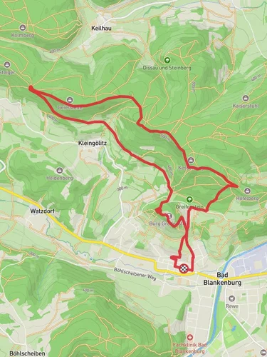
Starting near Saalfeld-Rudolstadt, Germany, the Schiller Wanderweg is a picturesque loop trail that spans approximately 11 km (around 6.8 miles) with an elevation gain of about 100 meters (328 feet). This medium-difficulty trail offers a blend of natural beauty and historical significance, making it a rewarding experience for hikers of various skill levels.
### Getting There To reach the trailhead, you can either drive or use public transportation. If you're driving, set your GPS to Saalfeld-Rudolstadt, a town well-connected by road. For those opting for public transport, take a train to Saalfeld (Saale) station, which is well-served by regional trains. From the station, local buses or a short taxi ride can get you to the trailhead.
### Trail Highlights
#### Historical Significance The Schiller Wanderweg is named after the famous German poet Friedrich Schiller, who spent time in this region. As you hike, you'll encounter several plaques and information boards detailing Schiller's life and works, adding a layer of cultural enrichment to your journey.
#### Natural Beauty The trail meanders through a variety of landscapes, including dense forests, open meadows, and serene riverbanks. The lush greenery is particularly vibrant in spring and summer, while autumn offers a stunning display of fall foliage.
#### Wildlife Keep an eye out for local wildlife such as deer, foxes, and a variety of bird species. Early morning or late afternoon hikes increase your chances of spotting these animals in their natural habitat.
### Key Landmarks
#### Saalfeld Fairy Grottoes Approximately 3 km (1.9 miles) into the hike, you'll come across the Saalfeld Fairy Grottoes, a series of colorful underground caverns. These grottoes are renowned for their stunning mineral formations and are considered one of the most beautiful show caves in the world.
#### Rudolstadt Castle Around the halfway mark, at about 5.5 km (3.4 miles), you'll find Rudolstadt Castle perched on a hill. This historic castle offers panoramic views of the surrounding countryside and is a great spot for a rest and some photography.
### Navigation For navigation, it's highly recommended to use the HiiKER app, which provides detailed maps and real-time updates. The trail is well-marked, but having a reliable navigation tool ensures you stay on track and can explore any interesting detours confidently.
### Preparation Tips - Footwear: Given the mixed terrain, sturdy hiking boots are advisable. - Weather: Check the weather forecast before you set out. The trail can be slippery after rain, so waterproof gear might be necessary. - Supplies: Carry enough water and snacks, as there are limited facilities along the route. - Timing: Allocate around 3-4 hours to complete the hike, allowing extra time for breaks and exploration.
### Safety Considerations - Trail Conditions: Be mindful of uneven ground and occasional steep sections. - Wildlife: While wildlife encounters are generally safe, it's best to observe animals from a distance. - Emergency: Ensure your phone is fully charged and that you have emergency contact numbers saved.
The Schiller Wanderweg offers a delightful mix of natural splendor and historical intrigue, making it a must-visit for anyone in the Saalfeld-Rudolstadt area.
Reviews
User comments, reviews and discussions about the Schiller Wanderweg, Germany.
5.0
average rating out of 5
2 rating(s)


