2.6 km
~41 min
103 m
“Embark on the Königsberg Loop for a scenic, moderately challenging hike rich in history and natural beauty.”
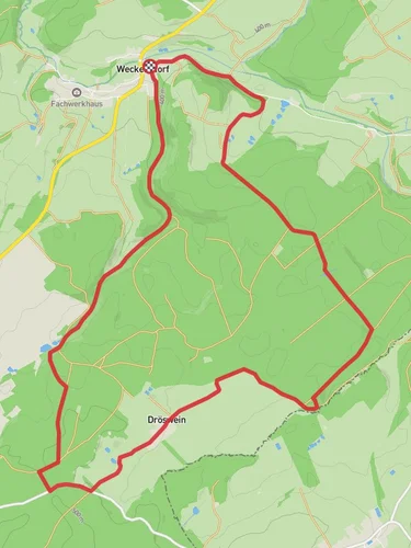
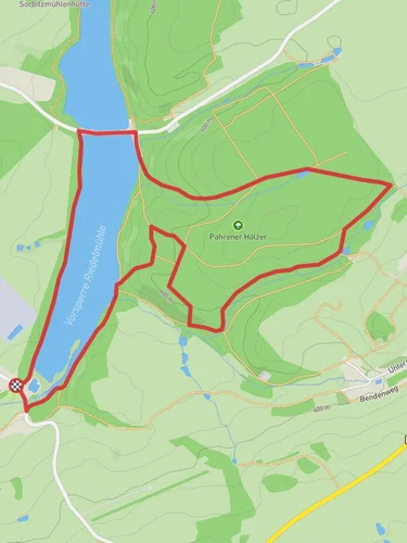
Starting your adventure near Saale-Orla-Kreis, Germany, the Königsberg Loop offers a delightful 3 km (1.86 miles) journey with an elevation gain of approximately 100 meters (328 feet). This loop trail is rated as medium difficulty, making it accessible for most hikers with a moderate level of fitness.
### Getting There To reach the trailhead, you can drive or use public transport. If driving, set your GPS to the nearest known address: Saale-Orla-Kreis, Germany. For those using public transport, the closest major town is Pößneck, which is well-connected by train. From Pößneck, you can take a local bus or taxi to the trailhead.
### Trail Overview The Königsberg Loop begins near a small parking area, easily identifiable by a wooden signpost marking the start of the trail. The initial section of the trail is relatively flat, winding through a serene forest of beech and oak trees. As you progress, the path starts to ascend gently, offering glimpses of the surrounding landscape through the foliage.
### Points of Interest #### Historical Significance About 1 km (0.62 miles) into the hike, you'll come across the ruins of an old watchtower, a remnant from the medieval period. This tower once served as a lookout point to protect the region from invaders. Take a moment to explore the ruins and imagine the historical significance of this strategic location.
#### Flora and Fauna The trail is rich in biodiversity. Keep an eye out for various bird species, including woodpeckers and songbirds. In the spring and summer months, the forest floor is carpeted with wildflowers, adding a splash of color to your hike. You might also spot deer and other small mammals that inhabit the area.
### Midway Point At approximately 1.5 km (0.93 miles), you'll reach the highest point of the trail, offering panoramic views of the Saale-Orla-Kreis region. This is a perfect spot to take a break, enjoy a snack, and soak in the natural beauty. The elevation gain here is about 100 meters (328 feet), providing a mild but rewarding challenge.
### Navigation The trail is well-marked with signs and blazes, but it's always a good idea to have a reliable navigation tool. HiiKER is an excellent app for this purpose, offering detailed maps and real-time tracking to ensure you stay on course.
### Descending Back The descent begins shortly after the midway point, leading you through a series of gentle switchbacks. This section of the trail is particularly scenic, with the path meandering alongside a small stream. The sound of flowing water adds a tranquil ambiance to your hike.
### Final Stretch As you approach the final kilometer, the trail flattens out and leads you back through the forest to the starting point. This section is relatively easy, allowing you to cool down and reflect on the journey.
### Practical Tips - Wear sturdy hiking boots, as the trail can be uneven in places. - Bring water and snacks, especially if you plan to take breaks and enjoy the scenery. - Check the weather forecast before heading out, as the trail can become slippery after rain. - Use HiiKER for navigation to ensure you stay on the correct path.
The Königsberg Loop is a delightful hike that combines natural beauty, historical intrigue, and a moderate physical challenge, making it a rewarding experience for any hiker.
Reviews
User comments, reviews and discussions about the Königsberg Loop, Germany.
0.0
average rating out of 5
0 rating(s)


