5.9 km
~1 hrs 16 min
57 m
“Explore Thalmaessing Spassweg 1 for a scenic, moderate 6 km hike through Franconian landscapes and history.”
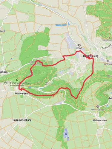
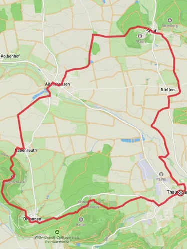
Starting near the charming town of Roth, Germany, the Thalmaessing Spassweg 1 is a delightful loop trail that spans approximately 6 kilometers (3.7 miles) with virtually no elevation gain, making it accessible for a wide range of hikers. This trail is estimated to be of medium difficulty, providing a balanced mix of leisurely walking and moderate challenges.
### Getting There
To reach the trailhead, you can either drive or use public transportation. If you're driving, Roth is well-connected via the A6 and A9 highways. For those opting for public transport, you can take a train to Roth station, which is serviced by regional trains from Nuremberg and other nearby cities. From Roth station, local buses or a short taxi ride will get you to the trailhead.
### Trail Highlights
#### Scenic Landscapes
As you embark on the Thalmaessing Spassweg 1, you'll be greeted by the picturesque landscapes of the Franconian countryside. The trail meanders through lush meadows, dense forests, and charming rural settings. The absence of significant elevation gain means you can fully immerse yourself in the natural beauty without the strain of steep climbs.
#### Flora and Fauna
The trail is a haven for nature enthusiasts. Keep an eye out for a variety of bird species, including woodpeckers and songbirds, which are commonly spotted in the area. The flora is equally diverse, with wildflowers dotting the meadows and ancient oak and beech trees providing ample shade along the forested sections.
#### Historical Significance
The region around Roth is steeped in history. As you hike, you'll come across several markers and plaques that provide insights into the local heritage. One notable landmark is the Thalmaessing Castle ruins, located approximately 3 kilometers (1.9 miles) into the trail. These ruins offer a glimpse into the medieval past of the area and are a perfect spot for a brief rest and some exploration.
### Navigation and Safety
Given the moderate difficulty of the trail, it's advisable to use a reliable navigation tool like HiiKER to ensure you stay on track. The trail is well-marked, but having a digital map can provide additional peace of mind.
### Practical Tips
- Footwear: Given the varied terrain, sturdy hiking boots are recommended. - Weather: Check the weather forecast before you set out, as the trail can become muddy after rain. - Supplies: Carry enough water and snacks, as there are limited facilities along the route. - Wildlife: While the area is generally safe, it's always good practice to be aware of your surroundings and respect local wildlife.
### Accessibility
The trail's loop design means you'll end up back where you started, making logistics simple. The lack of significant elevation gain makes it suitable for families and those looking for a more relaxed hiking experience.
Embark on the Thalmaessing Spassweg 1 for a delightful journey through the heart of Franconia, where natural beauty and historical intrigue await at every turn.
Reviews
User comments, reviews and discussions about the Thalmaessing Spassweg 1, Germany.
5.0
average rating out of 5
1 rating(s)


