14.7 km
~3 hrs 44 min
480 m
“Explore the Taunusshoehenweg and Ranseler Hoehenrausch Loop: 15 km of scenic views, history, and wildlife.”
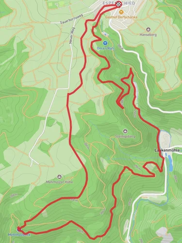
Starting near Rheingau-Taunus-Kreis, Germany, the Taunusshoehenweg and Ranseler Hoehenrausch Loop is a captivating 15 km (9.3 miles) loop trail with an elevation gain of approximately 400 meters (1,312 feet). This medium-difficulty trail offers a blend of natural beauty, historical landmarks, and diverse wildlife, making it a rewarding experience for hikers.
### Getting There To reach the trailhead, you can drive or use public transport. If driving, set your GPS to Rheingau-Taunus-Kreis, and look for parking near the trailhead. For public transport, take a train to Wiesbaden, then a bus to the nearest stop at Schlangenbad, which is a short walk from the trailhead.
### Trail Overview The trail begins with a gentle ascent through dense forests, where you'll be surrounded by towering trees and the sounds of local wildlife. As you progress, the trail opens up to panoramic views of the Taunus mountain range, offering a stunning backdrop for your hike.
### Key Landmarks and Points of Interest - Ranseler Hoehenrausch: At around the 5 km (3.1 miles) mark, you'll reach the Ranseler Hoehenrausch, a high point offering breathtaking views of the surrounding valleys and hills. This is a great spot to take a break and enjoy the scenery. - Historical Sites: The region is rich in history, with several ancient ruins and historical markers along the way. Keep an eye out for the remnants of old castles and fortifications, which date back to medieval times. - Natural Springs: Around the 8 km (5 miles) mark, you'll encounter natural springs that have been used for centuries for their purported healing properties. These springs are a great place to refill your water bottles and enjoy the cool, refreshing water.
### Flora and Fauna The trail is home to a diverse range of flora and fauna. In the spring and summer months, you'll find wildflowers in full bloom, adding a splash of color to the landscape. The forests are inhabited by deer, foxes, and a variety of bird species, making it a great trail for wildlife enthusiasts.
### Navigation and Safety Given the trail's moderate difficulty, it's advisable to use a reliable navigation tool like HiiKER to stay on track. The trail is well-marked, but having a digital map can be helpful, especially in areas where the path may be less clear.
### Final Stretch The final part of the loop takes you through open meadows and past small, picturesque villages. The descent is gradual, allowing you to take in the views and reflect on the journey as you make your way back to the trailhead.
This trail offers a perfect blend of natural beauty, historical intrigue, and moderate physical challenge, making it an excellent choice for hikers looking to explore the scenic and historical richness of the Rheingau-Taunus-Kreis region.
Reviews
User comments, reviews and discussions about the Taunusshoehenweg and Ranseler Hoehenrausch Loop, Germany.
4.0
average rating out of 5
6 rating(s)


