Download
Preview
Add to list
More
7.9 km
~1 hrs 53 min
194 m
Loop
“Explore lush forests, historical landmarks, and panoramic views on the rewarding Wollmerschied Loop trail.”
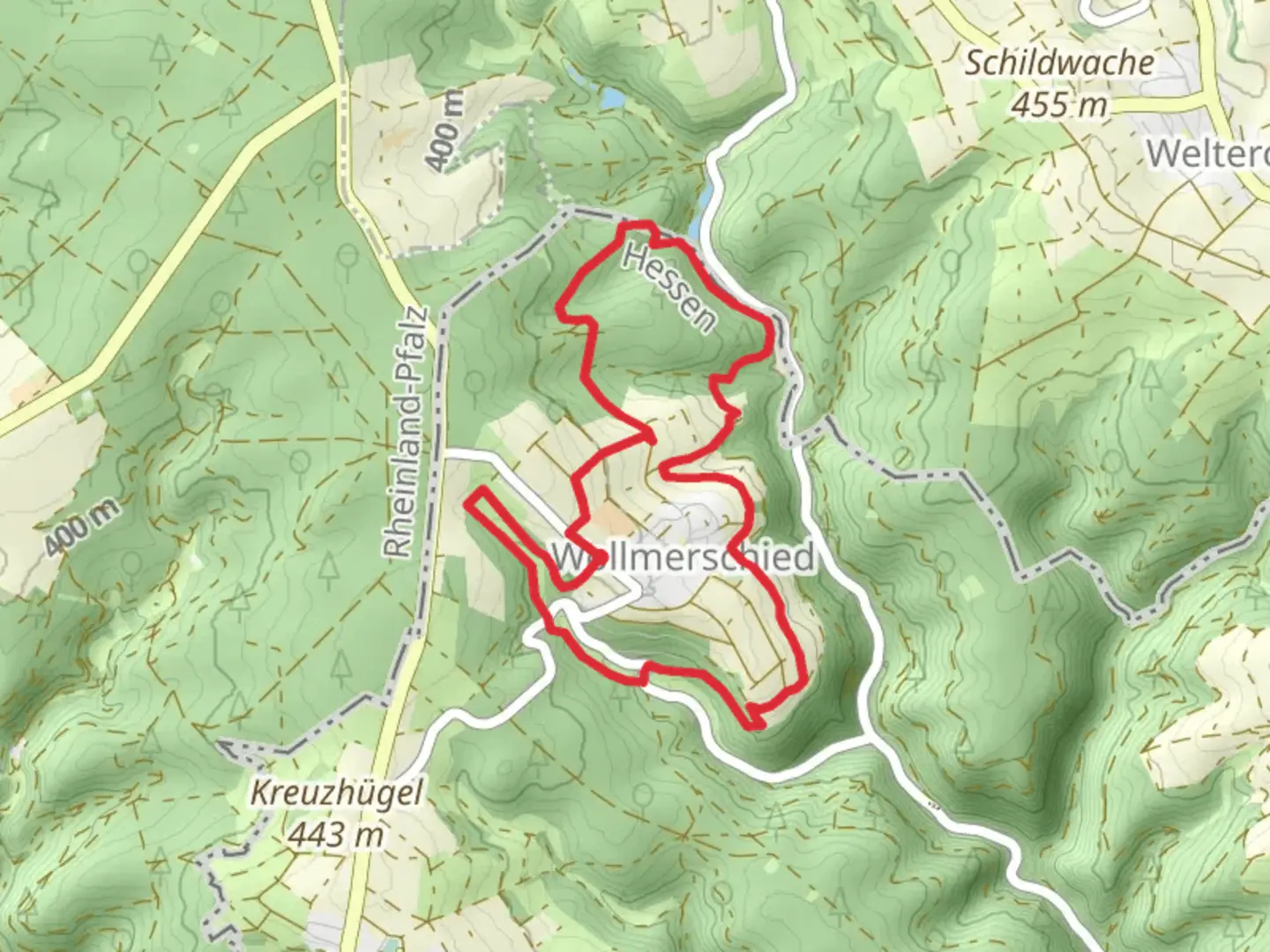
Starting near Rheingau-Taunus-Kreis, Germany, the Wollmerschied Loop via Wollmerschieder Grenzweg is a delightful 8 km (approximately 5 miles) loop trail with an elevation gain of around 100 meters (328 feet). This trail is rated as medium difficulty, making it suitable for moderately experienced hikers.
Getting There To reach the trailhead, you can drive or use public transport. If driving, set your GPS to Rheingau-Taunus-Kreis, and look for parking near the village of Wollmerschied. For those using public transport, take a train to the nearest major station, such as Wiesbaden Hauptbahnhof, and then a local bus to Wollmerschied. The bus schedules can be checked on local transit websites or apps.
Trail Navigation For navigation, it's highly recommended to use the HiiKER app, which provides detailed maps and real-time GPS tracking to ensure you stay on the correct path.
Trail Highlights The trail begins in the quaint village of Wollmerschied, where you can see traditional German architecture and perhaps grab a bite at a local café before setting off. As you start your hike, you'll be greeted by lush forests and rolling hills, typical of the Rheingau-Taunus region.
Nature and Wildlife The trail meanders through dense woodlands, where you might spot deer, foxes, and a variety of bird species. Keep an eye out for the European robin and the great spotted woodpecker, which are common in this area. The flora is equally impressive, with oak, beech, and pine trees dominating the landscape. During spring and summer, the forest floor is often carpeted with wildflowers, adding a splash of color to your hike.
Historical Significance One of the most intriguing aspects of this trail is its historical significance. The Wollmerschieder Grenzweg, or border path, has historical roots dating back to medieval times. It was once a boundary line between different territories, and you can still see old boundary stones along the way. These stones are marked with historical engravings, offering a glimpse into the region's past.
Key Landmarks At approximately the 4 km (2.5 miles) mark, you'll come across a scenic viewpoint that offers panoramic views of the surrounding countryside. This is a great spot to take a break and enjoy the scenery. Another notable landmark is an old hunting lodge located around the 6 km (3.7 miles) point. Though now in ruins, it provides a fascinating look into the area's history and is a popular spot for photography.
Elevation and Terrain The trail's elevation gain is moderate, with a total ascent of about 100 meters (328 feet). The terrain is varied, featuring both well-trodden paths and more rugged sections. Good hiking boots are recommended, especially after rain when the trail can become slippery.
Final Stretch As you loop back towards Wollmerschied, the trail descends gently, offering a relaxing end to your hike. The final stretch takes you through open meadows, where you can enjoy the last of the day's sunlight before returning to the village.
This trail offers a perfect blend of natural beauty, wildlife, and historical intrigue, making it a rewarding experience for any hiker.

What to expect?
Activity types
Comments and Reviews
User comments, reviews and discussions about the Wollmerschied Loop via Wollmerschieder Grenzweg, Germany.
5.0
average rating out of 5
1 rating(s)