9.3 km
~2 hrs 28 min
363 m
“Immerse in Rhein-Neckar-Kreis's natural beauty and history on the 9 km Wiesensteinigweg Loop hike.”
Starting your hike near the picturesque Rhein-Neckar-Kreis in Germany, the Wiesensteinigweg Loop offers a delightful 9 km (5.6 miles) journey with an elevation gain of approximately 300 meters (984 feet). This medium-difficulty loop trail is perfect for those looking to immerse themselves in the natural beauty and historical richness of the region.
### Getting There To reach the trailhead, you can drive or use public transport. If driving, set your GPS to the nearest known address: the village of Wilhelmsfeld, which is well-signposted and has ample parking facilities. For those using public transport, take a train to Heidelberg Hauptbahnhof and then a bus to Wilhelmsfeld. The bus ride offers scenic views and takes about 30 minutes.
### Trail Navigation For navigation, download the HiiKER app, which provides detailed maps and real-time updates to ensure you stay on track. The trail is well-marked, but having a digital guide can be invaluable.
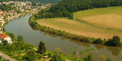
### Trail Highlights #### Nature and Wildlife As you embark on the Wiesensteinigweg Loop, you'll traverse through dense forests, open meadows, and rolling hills. The trail is particularly stunning in spring and autumn when the foliage is vibrant. Keep an eye out for local wildlife, including deer, foxes, and a variety of bird species. The forested sections are home to ancient oak and beech trees, providing a serene canopy overhead.
#### Significant Landmarks Around the 3 km (1.9 miles) mark, you'll come across the historic Wiesensteinig, a large rock formation that has been a local landmark for centuries. This spot offers a great place to take a break and enjoy the panoramic views of the surrounding countryside.
At approximately 5 km (3.1 miles), you'll reach the highest point of the trail, offering breathtaking vistas of the Odenwald forest and the distant Rhine Valley. This is an excellent spot for photography, so make sure your camera is ready.
### Historical Significance The Rhein-Neckar-Kreis region is steeped in history. The trail passes near several ancient Roman sites, and you might even spot remnants of old Roman roads and settlements. The area was a significant part of the Roman Empire's frontier, and many artifacts have been discovered here.
### Practical Tips - Footwear: Given the mixed terrain, sturdy hiking boots are recommended. - Weather: Check the weather forecast before you go. The trail can be muddy after rain, making some sections slippery. - Supplies: Bring enough water and snacks, as there are limited facilities along the trail. - Wildlife: While wildlife sightings are common, always maintain a respectful distance and avoid feeding animals.
### Final Stretch As you loop back towards Wilhelmsfeld, the trail descends gently, offering a relaxing end to your hike. The final 2 km (1.2 miles) take you through a charming section of the forest, where you might encounter local hikers and families enjoying the outdoors.
By the time you return to the trailhead, you'll have experienced a diverse range of landscapes and gained a deeper appreciation for the natural and historical richness of the Rhein-Neckar-Kreis region.
Reviews
User comments, reviews and discussions about the Wiesensteinigweg Loop, Germany.
4.0
average rating out of 5
2 rating(s)


