14.1 km
~3 hrs 37 min
486 m
“Discover nature, history, and culture on the scenic, moderate 14 km Neckarsteig and Langenthal loop trail.”
Starting near Kreis Bergstraße in Germany, this 14 km (8.7 miles) loop trail offers a moderate challenge with an elevation gain of approximately 400 meters (1,312 feet). The Neckarsteig and Langenthal trail is a delightful blend of natural beauty, historical landmarks, and cultural heritage, making it a rewarding experience for hikers.
### Getting There To reach the trailhead, you can either drive or use public transport. If driving, set your GPS to Kreis Bergstraße, Germany. For those using public transport, the nearest major town is Heidelberg. From Heidelberg, you can take a regional train to Neckargemünd, followed by a local bus to Kreis Bergstraße. The trailhead is conveniently located near the bus stop, making it easily accessible.
### Trail Highlights As you embark on the trail, you'll find yourself immersed in the lush forests and rolling hills characteristic of the Odenwald region. The trail is well-marked, but it's advisable to use HiiKER for navigation to ensure you stay on the right path.
#### Historical Significance One of the most captivating aspects of this trail is its historical significance. The Neckarsteig is part of a larger network of trails that have been used for centuries. Along the way, you'll encounter several historical landmarks, including the ruins of Dilsberg Castle. This medieval fortress, perched on a hilltop, offers panoramic views of the Neckar River and the surrounding countryside. The castle dates back to the 12th century and provides a fascinating glimpse into the region's past.
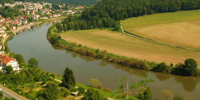
#### Natural Beauty The trail meanders through dense forests, open meadows, and along the banks of the Neckar River. In spring and summer, the meadows are adorned with wildflowers, while autumn brings a stunning display of fall foliage. Keep an eye out for local wildlife, including deer, foxes, and a variety of bird species. The trail also passes through several small villages, where you can take a break and enjoy some local cuisine.
### Key Sections - First 5 km (3.1 miles): The initial part of the trail is relatively gentle, with a gradual ascent through the forest. You'll pass by several small streams and might spot some local wildlife. - Midpoint (7 km / 4.3 miles): As you reach the midpoint, the trail becomes steeper, leading you to the ruins of Dilsberg Castle. This is a great spot to take a break, explore the ruins, and enjoy the views. - Final 7 km (4.3 miles): The descent takes you through more open terrain, offering expansive views of the Neckar Valley. The trail loops back towards Kreis Bergstraße, passing through picturesque villages and vineyards.
### Preparation Tips Given the moderate difficulty of the trail, it's important to come prepared. Wear sturdy hiking boots, bring plenty of water, and pack some snacks or a light lunch. The weather can be unpredictable, so it's wise to carry a rain jacket and some extra layers. Using HiiKER for navigation will help you stay on track and make the most of your hike.
This trail offers a perfect blend of natural beauty, historical intrigue, and cultural experiences, making it a must-visit for any hiking enthusiast.
Reviews
User comments, reviews and discussions about the Neckarsteig and Langenthal, Germany.
5.0
average rating out of 5
2 rating(s)


