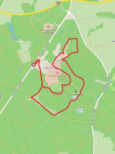
8.8 km
~1 hrs 56 min
103 m
“The Boxberg Loop offers a scenic 9 km hike with moderate difficulty, lush forests, and panoramic summit views.”
Starting near Rendsburg-Eckernförde in Germany, the Boxberg Loop via Wanderroute Waldhuetten is a delightful 9 km (approximately 5.6 miles) loop trail with an elevation gain of around 100 meters (328 feet). This trail is rated as medium difficulty, making it suitable for moderately experienced hikers.
### Getting There To reach the trailhead, you can drive or use public transport. If driving, set your GPS to the vicinity of Rendsburg-Eckernförde. For those using public transport, the nearest significant landmark is the Rendsburg train station. From there, local buses or a short taxi ride can get you to the trailhead.
### Trail Overview The trail begins in a lush forested area, providing a serene start to your hike. The initial section is relatively flat, allowing you to ease into the journey. As you progress, the trail gradually ascends, offering a moderate challenge without being overly strenuous.
### Key Landmarks and Points of Interest - Waldhuetten: About 2 km (1.2 miles) into the hike, you'll come across the Waldhuetten, a series of charming forest huts. These huts are a great spot to take a short break and enjoy the surrounding nature. - Boxberg Summit: Roughly halfway through the loop, you'll reach the highest point of the trail, the Boxberg Summit. At an elevation of 100 meters (328 feet), it offers panoramic views of the surrounding forest and countryside. This is an excellent spot for photography and a well-deserved rest. - Historical Significance: The region around Rendsburg-Eckernförde has a rich history dating back to medieval times. While the trail itself is primarily a nature hike, the nearby town of Rendsburg features historical architecture and landmarks worth exploring if you have extra time.
### Flora and Fauna The trail is enveloped in dense forest, predominantly consisting of beech and oak trees. In spring and summer, the forest floor is carpeted with wildflowers, adding a splash of color to your hike. Wildlife enthusiasts might spot deer, foxes, and a variety of bird species, including woodpeckers and owls.
### Navigation and Safety The trail is well-marked, but it's always a good idea to have a reliable navigation tool. HiiKER is recommended for its detailed maps and real-time tracking features. Ensure you have adequate water and snacks, as there are no facilities along the trail. Wear sturdy hiking boots, especially after rain, as some sections can become muddy and slippery.
### Final Stretch The descent from Boxberg Summit is gradual, leading you back through the forest and eventually looping back to the starting point. The final 2 km (1.2 miles) are relatively flat, allowing for a relaxed end to your hike.
This trail offers a balanced mix of natural beauty, moderate physical challenge, and a touch of historical context, making it a rewarding experience for any hiker.
Reviews
User comments, reviews and discussions about the Boxberg Loop via Wanderroute Waldhuetten, Germany.
5.0
average rating out of 5
6 rating(s)


