9.2 km
~2 hrs 12 min
220 m
“Explore the Gipsbruchweiher and Alatsee Via Alpina Purple trail: a 9 km loop of natural beauty and history.”
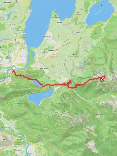
Starting your adventure near Ostallgäu, Germany, the Gipsbruchweiher and Alatsee Via Alpina Purple trail offers a delightful 9 km (5.6 miles) loop with an elevation gain of around 200 meters (656 feet). This medium-difficulty trail is perfect for those looking to immerse themselves in the natural beauty and historical richness of the region.
### Getting There To reach the trailhead, you can either drive or use public transport. If driving, set your GPS to the nearest known address: Alatsee, 87629 Füssen, Germany. For public transport, take a train to Füssen and then a local bus towards Alatsee. The trailhead is conveniently located near the lake, making it easily accessible.
### Trail Overview The trail begins near the picturesque Alatsee, a small, serene lake known for its unique, slightly reddish water due to the presence of certain bacteria. As you start your hike, you'll be surrounded by lush forests and the tranquil sounds of nature. The initial part of the trail is relatively flat, allowing you to ease into the hike.
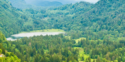
### Key Landmarks and Nature About 2 km (1.2 miles) into the hike, you'll come across the Gipsbruchweiher, a small pond that offers a peaceful spot for a short break. The pond is surrounded by dense forest, providing a perfect habitat for various bird species and small mammals. Keep an eye out for deer and foxes, which are commonly seen in this area.
Continuing on, the trail gradually ascends, offering stunning views of the surrounding Allgäu Alps. Around the 4 km (2.5 miles) mark, you'll reach the highest point of the trail, approximately 200 meters (656 feet) above the starting elevation. This section provides panoramic views that are particularly breathtaking during the fall when the foliage turns vibrant shades of red and gold.
### Historical Significance The region around Ostallgäu is steeped in history. The trail passes near several historical landmarks, including remnants of old gypsum quarries, which were once a significant part of the local economy. These quarries date back to the 19th century and offer a glimpse into the industrial past of the area.
### Navigation and Safety For navigation, it's highly recommended to use the HiiKER app, which provides detailed maps and real-time updates. The trail is well-marked, but having a reliable navigation tool ensures you stay on track and can enjoy your hike without any worries.
### Wildlife and Flora The diverse ecosystem along the trail is home to a variety of wildlife. In addition to deer and foxes, you might spot squirrels, hares, and a range of bird species, including woodpeckers and owls. The flora is equally diverse, with dense forests of beech, oak, and pine trees. During spring and summer, the trail is adorned with wildflowers, adding a splash of color to your hike.
### Final Stretch As you descend back towards Alatsee, the trail offers a gentle slope, making for a relaxing end to your hike. The final 2 km (1.2 miles) loop around the lake, providing ample opportunities to take in the serene waters and perhaps even spot some local fish species.
This trail is a perfect blend of natural beauty, historical intrigue, and moderate physical challenge, making it a must-visit for any hiking enthusiast.
Reviews
User comments, reviews and discussions about the Gipsbruchweiher and Alatsee Via Alpina Purple, Germany.
5.0
average rating out of 5
9 rating(s)


