Füssen to Tegelberg via Wasserlaeufer Route and Schwansee
11.0 km
~4 hrs 26 min
1340 m
“Embark on a breathtaking, challenging alpine adventure through lush forests, panoramic vistas, and historical charm.”
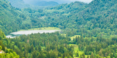
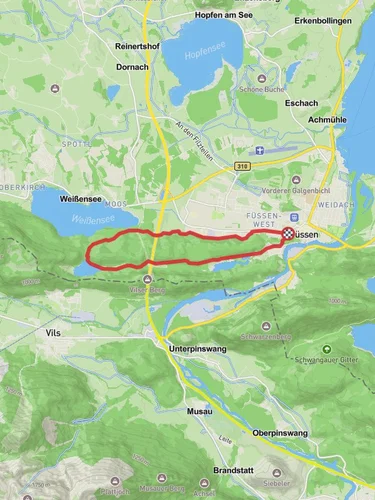
Nestled in the picturesque region of Ostallgäu, Germany, this challenging trail from Füssen to Tegelberg via the Wasserläufer Route and Schwansee offers an unforgettable adventure for seasoned hikers. Spanning approximately 11 kilometers (about 6.8 miles) with a significant elevation gain of around 1300 meters (4265 feet), this point-to-point trail is rated as extra difficult, demanding both physical endurance and careful planning.### Getting ThereThe trailhead is conveniently located near the charming town of Füssen, which is accessible by both car and public transport. If you're driving, you can park near the Füssen train station or in designated parking areas around the town. For those relying on public transport, Füssen is well-connected by train, with regular services from Munich and Augsburg. From the train station, it's a short walk to the start of the trail.### Trail HighlightsAs you embark on this journey, the trail initially meanders through lush forests and alongside the serene Schwansee, a small lake known for its tranquil beauty and the occasional sighting of swans. This area is a haven for birdwatchers, with various species inhabiting the surrounding woodlands.Continuing along the Wasserläufer Route, the trail begins to ascend more steeply, offering breathtaking views of the Bavarian Alps. The ascent is demanding, with rocky paths and steep inclines, so sturdy hiking boots and trekking poles are recommended. As you climb, you'll be rewarded with panoramic vistas of the surrounding valleys and distant peaks.### Historical SignificanceThis region is steeped in history, with the nearby Neuschwanstein Castle, a 19th-century Romanesque Revival palace, adding a fairy-tale charm to the landscape. Although not directly on the trail, the castle is visible from various vantage points along the route, providing a glimpse into the area's rich cultural heritage.### Navigational TipsGiven the trail's complexity and the potential for rapidly changing weather conditions, it's crucial to be well-prepared. Utilize the HiiKER app for accurate navigation and real-time updates on trail conditions. The app's offline maps feature is particularly useful in areas with limited cell service.### Flora and FaunaThe trail traverses diverse ecosystems, from dense forests to alpine meadows. In spring and summer, the meadows burst into color with wildflowers, while autumn brings a stunning display of foliage. Wildlife enthusiasts may encounter deer, marmots, and a variety of bird species, making this hike a rewarding experience for nature lovers.### Final Ascent to TegelbergThe final stretch to Tegelberg is the most challenging, with a steep climb that tests even the most experienced hikers. However, reaching the summit is immensely satisfying, offering sweeping views of the surrounding alpine landscape. At the top, the Tegelberg cable car provides an alternative descent option for those who prefer a more leisurely return to the valley.This trail is a true test of endurance and skill, offering a blend of natural beauty, historical intrigue, and the thrill of alpine hiking. Proper preparation and respect for the trail's challenges will ensure a safe and memorable adventure.
Reviews
User comments, reviews and discussions about the Füssen to Tegelberg via Wasserlaeufer Route and Schwansee, Germany.
4.0
average rating out of 5
4 rating(s)
Loading reviews...


