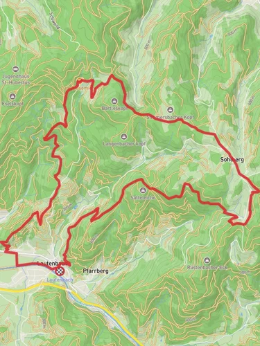
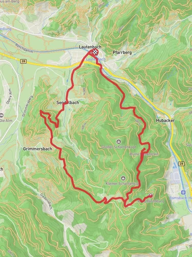
11.9 km
~3 hrs 35 min
735 m
“This 12 km loop near Ortenaukreis blends challenging ascents, serene forests, and historical landmarks for a rewarding hike.”
Starting near Ortenaukreis, Germany, this 12 km (7.5 miles) loop trail offers a moderate challenge with an elevation gain of approximately 700 meters (2,297 feet). The trailhead is conveniently accessible by both public transport and car. If you're driving, you can park near the town of Oberkirch, which is the nearest significant landmark. For those using public transport, take a train to Oberkirch station and then a local bus to the trailhead.
### Initial Ascent and Forested Pathways
The trail begins with a steady ascent through dense forest, providing a cool and shaded environment. The initial climb is about 3 km (1.9 miles) with an elevation gain of around 300 meters (984 feet). As you navigate this section, you'll encounter a variety of flora, including oak, beech, and pine trees. Keep an eye out for local wildlife such as deer and various bird species.
### Oberer Hoellwald
Around the 4 km (2.5 miles) mark, you'll reach the Oberer Hoellwald area. This section is known for its lush greenery and serene atmosphere. The trail here is relatively flat, allowing you to catch your breath and enjoy the surroundings. There are several small streams and brooks, which add to the tranquility of the area. This is a great spot to take a short break and hydrate.
### Otschenfeld-Schaertenkopf Huette
Continuing on, the trail leads you to the Otschenfeld-Schaertenkopf Huette, approximately 7 km (4.3 miles) into the hike. This hut is a significant landmark and offers a glimpse into the region's history. Originally used by shepherds, it now serves as a rest stop for hikers. The hut is situated at an elevation of about 600 meters (1,968 feet), providing panoramic views of the surrounding valleys and hills. This is an ideal spot for a longer break or even a picnic.
### Descent and Return Loop
The descent begins shortly after the hut, with the trail winding down through more forested areas. This section is about 5 km (3.1 miles) and includes a mix of gentle slopes and steeper declines. The path can be rocky in places, so sturdy hiking boots are recommended. As you make your way back, you'll pass through open meadows and small clearings, offering different perspectives of the landscape.
### Navigation and Safety
For navigation, it's highly recommended to use the HiiKER app, which provides detailed maps and real-time updates. The trail is well-marked, but having a reliable navigation tool ensures you stay on track. Be mindful of the weather, as conditions can change rapidly, especially at higher elevations. Carry sufficient water, snacks, and a basic first aid kit.
### Historical Significance
The region around Ortenaukreis has a rich history dating back to Roman times. The trails you hike today were once used by traders and shepherds. The Otschenfeld-Schaertenkopf Huette itself is a testament to the area's pastoral heritage. Exploring this trail not only offers natural beauty but also a connection to the historical tapestry of the region.
This 12 km loop trail near Ortenaukreis provides a balanced mix of challenging ascents, serene forest paths, and historical landmarks, making it a rewarding experience for moderately experienced hikers.
Reviews
User comments, reviews and discussions about the Oberer Hoellwald and Otschenfeld-Schaertenkopf Huette, Germany.
0.0
average rating out of 5
0 rating(s)


