15.0 km
~4 hrs 27 min
877 m
“Explore the scenic Lautenbacher Hexensteig and Renchtalsteig, a 15 km trail rich in nature and history.”
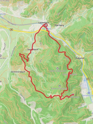
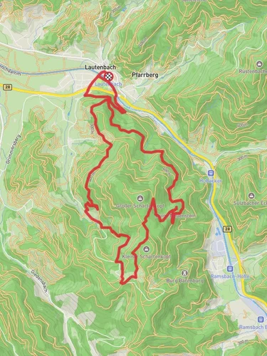
Starting near Ortenaukreis, Germany, the Lautenbacher Hexensteig and Renchtalsteig is a captivating 15 km (9.3 miles) loop trail with an elevation gain of approximately 800 meters (2,625 feet). This trail is rated as medium difficulty, making it suitable for hikers with some experience and a good level of fitness.
### Getting There To reach the trailhead, you can drive or use public transport. If driving, set your GPS to Lautenbach, a small town in the Ortenaukreis district. There is ample parking available near the trailhead. For those using public transport, take a train to Oberkirch station, which is well-connected to major cities like Offenburg and Strasbourg. From Oberkirch, you can catch a local bus to Lautenbach.
### Trail Navigation For navigation, it is highly recommended to use the HiiKER app, which provides detailed maps and real-time updates. This will ensure you stay on track and can easily find points of interest along the way.
### Trail Highlights The trail begins in the picturesque village of Lautenbach, known for its charming half-timbered houses and the historic pilgrimage church, Mariä Krönung. As you start your ascent, you'll pass through dense forests of beech and oak, offering a serene and shaded environment.
#### Nature and Wildlife The trail is rich in biodiversity. Keep an eye out for deer, foxes, and a variety of bird species. In spring and summer, the forest floor is carpeted with wildflowers, including orchids and lilies. The higher elevations offer stunning views of the Rench Valley and the Black Forest.
#### Historical Significance One of the most significant landmarks on this trail is the ruins of the Schauenburg Castle, located approximately 5 km (3.1 miles) from the start. Built in the 11th century, the castle offers a glimpse into the region's medieval past. The ruins are accessible and provide a great spot for a break and some exploration.
### Elevation and Terrain The trail features a mix of terrains, including forest paths, rocky sections, and open meadows. The initial 5 km (3.1 miles) involve a steady climb, gaining about 400 meters (1,312 feet) in elevation. This section can be challenging, but the well-maintained paths make it manageable. The next 5 km (3.1 miles) are relatively flat, allowing you to catch your breath and enjoy the scenery. The final 5 km (3.1 miles) involve a descent back to Lautenbach, which can be steep in places, so watch your footing.
### Points of Interest Around the 10 km (6.2 miles) mark, you'll come across the Renchtalsteig viewpoint. This spot offers panoramic views of the Rench Valley and is an excellent place for photography. There are also several benches where you can rest and take in the scenery.
### Practical Tips - Water and Food: There are no water sources along the trail, so carry at least 2 liters of water per person. Pack a lunch and some snacks, as there are several scenic spots perfect for a picnic. - Clothing and Gear: Wear sturdy hiking boots with good ankle support. Dress in layers, as the weather can change rapidly, especially at higher elevations. A rain jacket is advisable. - Safety: Mobile reception can be spotty in some areas, so inform someone about your hiking plans and expected return time. Carry a basic first-aid kit and a map, even if you are using the HiiKER app.
This trail offers a perfect blend of natural beauty, historical landmarks, and moderate physical challenge, making it a rewarding experience for any hiker.
Reviews
User comments, reviews and discussions about the Lautenbacher Hexensteig and Renchtalsteig, Germany.
0.0
average rating out of 5
0 rating(s)


