11.0 km
~2 hrs 52 min
410 m
“Explore the Unnenberg Rundweg Loop, a scenic 11 km trail in Germany with historic ruins and panoramic views.”
Starting near Oberbergischer Kreis in Germany, the Unnenberg Rundweg Loop is a captivating 11 km (approximately 6.8 miles) trail with an elevation gain of around 400 meters (about 1,312 feet). This loop trail is rated as medium difficulty, making it suitable for moderately experienced hikers.
### Getting There To reach the trailhead, you can drive or use public transport. If driving, set your GPS to Oberbergischer Kreis, and look for parking near the Unnenberg Tower, a well-known landmark in the area. For those using public transport, take a train to Gummersbach station and then a bus to Marienheide, from where you can catch a local taxi or hike a short distance to the trailhead.
### Trail Navigation For navigation, it is highly recommended to use the HiiKER app, which provides detailed maps and real-time updates. The trail is well-marked, but having a reliable navigation tool will enhance your hiking experience.
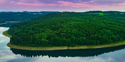
### Trail Highlights The trail begins with a gentle ascent through dense forests, offering a serene environment filled with the sounds of chirping birds and rustling leaves. After about 2 km (1.2 miles), you will reach the first significant viewpoint, providing panoramic views of the surrounding valleys and hills.
### Flora and Fauna As you continue, the trail meanders through mixed woodlands, where you can spot a variety of flora such as oak, beech, and pine trees. Wildlife enthusiasts might catch glimpses of deer, foxes, and a variety of bird species, including woodpeckers and owls.
### Historical Significance Around the 5 km (3.1 miles) mark, you will come across remnants of historical significance. The area is dotted with old stone walls and ruins that date back to medieval times, offering a glimpse into the region's rich history. These ruins are believed to be part of ancient settlements that once thrived in the area.
### Unnenberg Tower One of the trail's highlights is the Unnenberg Tower, located approximately 7 km (4.3 miles) into the hike. This observation tower stands at 506 meters (1,660 feet) above sea level and offers breathtaking 360-degree views of the Oberbergischer Kreis region. It's an excellent spot for a rest and some photography.
### Final Stretch The final 4 km (2.5 miles) of the trail involve a descent back towards the starting point. This section is relatively easier and allows you to enjoy the tranquil surroundings. Keep an eye out for small streams and brooks that add to the trail's charm.
### Preparation Tips Given the medium difficulty rating, ensure you wear sturdy hiking boots and carry sufficient water and snacks. Weather can be unpredictable, so pack a light rain jacket. The trail can be muddy in sections, especially after rain, so be prepared for varying trail conditions.
By following these guidelines and using the HiiKER app for navigation, you can fully enjoy the Unnenberg Rundweg Loop and all the natural and historical wonders it has to offer.
Reviews
User comments, reviews and discussions about the Unnenberg Rundweg Loop, Germany.
4.0
average rating out of 5
1 rating(s)


