9.6 km
~2 hrs 25 min
303 m
“The Genkeltalsperre via Lantenbach Rundweg is a scenic 10 km hike showcasing natural and historical beauty.”
Starting your hike near Oberbergischer Kreis, Germany, the Genkeltalsperre via Lantenbach Rundweg is a scenic loop trail that spans approximately 10 kilometers (6.2 miles) with an elevation gain of around 300 meters (984 feet). This medium-difficulty trail offers a blend of natural beauty, historical landmarks, and diverse wildlife, making it a rewarding experience for hikers.
### Getting There To reach the trailhead, you can drive or use public transport. If driving, set your GPS to the nearest known address: Genkeltalsperre, 51647 Gummersbach, Germany. For those using public transport, take a train to Gummersbach station and then a local bus towards Genkeltalsperre. The bus stop is conveniently located near the trailhead.
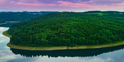
### Trail Overview The trail begins near the Genkeltalsperre, a picturesque reservoir that serves as a significant water source for the region. As you start your hike, you'll be greeted by the serene waters of the reservoir, surrounded by lush forests and rolling hills. The initial section of the trail is relatively flat, making it an excellent warm-up for the more challenging parts ahead.
### Key Landmarks and Sections #### Genkeltalsperre Reservoir At approximately 2 kilometers (1.2 miles) into the hike, you'll reach the Genkeltalsperre Reservoir. This man-made lake is not only a crucial water supply but also a habitat for various bird species. Keep an eye out for herons and kingfishers as you walk along the reservoir's edge.
#### Lantenbach Valley Around the 5-kilometer (3.1 miles) mark, you'll enter the Lantenbach Valley. This section of the trail features a moderate incline, gaining about 150 meters (492 feet) in elevation. The valley is known for its dense forests and the Lantenbach stream, which adds a soothing soundtrack to your hike. This area is also rich in flora, with a variety of wildflowers and ferns lining the path.
#### Historical Significance As you continue, you'll come across remnants of old mills and farmhouses, offering a glimpse into the region's agricultural past. These structures date back to the 18th and 19th centuries and are a testament to the area's historical significance. Take a moment to appreciate the craftsmanship and imagine the lives of those who once inhabited these lands.
### Wildlife and Nature The trail is home to a diverse range of wildlife. In addition to birds, you might spot deer, foxes, and even wild boar. The forested areas are rich in biodiversity, with oak, beech, and pine trees providing a canopy that shelters various species of plants and animals.
### Navigation and Safety To ensure you stay on track, use the HiiKER app for navigation. The trail is well-marked, but having a reliable navigation tool can help you avoid any wrong turns. Wear sturdy hiking boots, as some sections can be rocky and uneven. Bring plenty of water and snacks, especially if you plan to take breaks and enjoy the scenery.
### Final Stretch The last 2 kilometers (1.2 miles) of the trail loop back towards the Genkeltalsperre Reservoir. This section is mostly downhill, offering a gentle descent that allows you to relax and reflect on the hike. As you approach the trailhead, you'll have one last opportunity to take in the stunning views of the reservoir and surrounding landscape.
This trail offers a perfect blend of natural beauty, historical landmarks, and diverse wildlife, making it a must-visit for any hiking enthusiast.
Reviews
User comments, reviews and discussions about the Genkeltalsperre via Lantenbach Rundweg, Germany.
0.0
average rating out of 5
0 rating(s)


