9.0 km
~2 hrs 11 min
232 m
“Explore the scenic 9 km Talsperre Lichtenberg Loop, rich in history, wildlife, and moderate hiking challenges.”
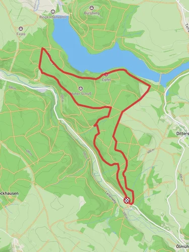
Starting near Mittelsachsen, Germany, the Talsperre Lichtenberg and Vorsperre Dittersbach Loop is a captivating 9 km (5.6 miles) trail with an elevation gain of around 200 meters (656 feet). This loop trail offers a medium difficulty rating, making it suitable for moderately experienced hikers.
### Getting There To reach the trailhead, you can either drive or use public transport. If driving, set your GPS to the vicinity of Mittelsachsen, specifically near the Lichtenberg Dam. For those using public transport, take a train to the nearest station in Mittweida and then a local bus towards Lichtenberg. The trailhead is conveniently located near the dam, making it easily accessible.
### Trail Overview The loop begins near the Lichtenberg Dam, a significant landmark in the area. The dam itself is an engineering marvel, constructed in the early 20th century to provide water supply and flood protection. As you start your hike, you'll be greeted by the serene waters of the reservoir, reflecting the surrounding forested hills.
### Key Sections and Landmarks
#### Lichtenberg Dam Approximately 1 km (0.6 miles) into the hike, you'll reach the Lichtenberg Dam. Take a moment to appreciate the historical significance of this structure, which has been a vital part of the region's water management system for over a century. The dam also offers picturesque views of the reservoir and the surrounding landscape.
#### Forested Trails Continuing along the trail, you'll enter a dense forest area around the 3 km (1.9 miles) mark. The forest is home to a variety of wildlife, including deer, foxes, and numerous bird species. Keep an eye out for these creatures, especially during the early morning or late afternoon hours. The forested section also provides ample shade, making it a pleasant walk even on warmer days.
#### Vorsperre Dittersbach Around the 5 km (3.1 miles) point, you'll come across the Vorsperre Dittersbach, a smaller auxiliary dam. This area is less frequented, offering a peaceful spot to take a break and enjoy the natural surroundings. The auxiliary dam plays a crucial role in regulating water flow to the main reservoir.
### Elevation and Terrain The trail features a moderate elevation gain of around 200 meters (656 feet), with a mix of gentle inclines and steeper sections. The terrain varies from well-maintained paths near the dams to more rugged, natural trails within the forest. Good hiking boots are recommended to navigate the diverse terrain comfortably.
### Navigation For navigation, it's advisable to use the HiiKER app, which provides detailed maps and real-time updates. The trail is well-marked, but having a reliable navigation tool ensures you stay on track and can explore any interesting detours with confidence.
### Flora and Fauna The trail is rich in biodiversity. In spring and summer, the forest floor is carpeted with wildflowers, while autumn brings a stunning display of foliage. The reservoir areas attract various waterfowl, making it a great spot for birdwatching.
### Historical Significance The Lichtenberg Dam and Vorsperre Dittersbach are not just functional structures but also historical landmarks. Built in the early 1900s, they have played a crucial role in the region's development, providing water for agriculture, industry, and domestic use. The dams also have a storied past, having withstood natural disasters and wartime challenges.
This loop trail offers a blend of natural beauty, wildlife, and historical significance, making it a rewarding hike for those looking to explore the scenic and historical aspects of Mittelsachsen.
Reviews
User comments, reviews and discussions about the Talsperre Lichtenberg and Vorsperre Dittersbach Loop, Germany.
0.0
average rating out of 5
0 rating(s)


