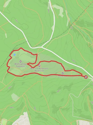
Teufelsfels, Baerenfels, Baerenfelsweiher and Adelsfelsen via Felsenweg Losheim
14.4 km
~3 hrs 32 min
401 m
“A scenic 14 km trail in Merzig-Wadern, blending natural beauty, historical landmarks, and moderate challenge.”
Starting near Merzig-Wadern in Germany, this 14 km (approximately 8.7 miles) loop trail offers a moderate challenge with an elevation gain of around 400 meters (about 1,312 feet). The trailhead is easily accessible by car, with parking available nearby. For those using public transport, the nearest significant landmark is the Losheim am See train station, from where local buses or a short taxi ride can take you to the trailhead.
### Trail Overview
The trail begins with a gentle ascent through dense forest, providing a serene start to your hike. As you progress, you'll encounter the first significant landmark, Teufelsfels, a striking rock formation that offers panoramic views of the surrounding landscape. This section is approximately 3 km (1.9 miles) into the hike and involves an elevation gain of about 150 meters (492 feet).
### Baerenfels and Baerenfelsweiher
Continuing along the trail, you'll reach Baerenfels, another impressive rock formation. This area is rich in local flora and fauna, so keep an eye out for various bird species and small mammals. The trail then descends slightly towards Baerenfelsweiher, a picturesque pond that serves as a perfect spot for a short break. This section is around 6 km (3.7 miles) from the start, with a cumulative elevation gain of about 250 meters (820 feet).
### Adelsfelsen and Historical Significance
The next major landmark is Adelsfelsen, a rock formation steeped in local history. This area was historically significant as a lookout point during medieval times, offering strategic views of the surrounding valleys. The trail to Adelsfelsen involves a steeper ascent, adding another 100 meters (328 feet) to your elevation gain. This section is approximately 10 km (6.2 miles) into the hike.
### Final Stretch
The final stretch of the trail takes you back through lush forest and rolling hills, gradually descending towards the trailhead. This section is relatively easier, allowing you to enjoy the natural beauty of the region without much physical exertion. The last 4 km (2.5 miles) of the trail bring the total elevation gain to around 400 meters (1,312 feet).
### Navigation and Safety
For navigation, it's highly recommended to use HiiKER, which provides detailed maps and real-time updates. The trail is well-marked, but having a reliable navigation tool ensures you stay on track. Be prepared for varying weather conditions and carry sufficient water and snacks. The trail is generally safe, but always be cautious on steeper sections and near rock formations.
This trail offers a blend of natural beauty, historical landmarks, and moderate physical challenge, making it a rewarding experience for hikers of all levels.
Reviews
User comments, reviews and discussions about the Teufelsfels, Baerenfels, Baerenfelsweiher and Adelsfelsen via Felsenweg Losheim, Germany.
0.0
average rating out of 5
0 rating(s)


