11.7 km
~2 hrs 50 min
295 m
“This 12 km loop trail near Märkischer Kreis offers lush forests, panoramic meadows, and historical landmarks.”
Starting near Märkischer Kreis in Germany, this 12 km (7.5 miles) loop trail offers a moderate challenge with an elevation gain of approximately 200 meters (656 feet). The trailhead is conveniently accessible by both car and public transport. If driving, you can park near the town of Neuenrade, which is well-signposted and offers ample parking facilities. For those using public transport, the nearest significant landmark is the Neuenrade train station, from where you can either walk or take a local bus to the trailhead.
### Initial Ascent and Forested Areas The trail begins with a gentle ascent through lush, mixed forests. This initial section is relatively easy, allowing you to acclimate to the terrain. The forest is home to a variety of wildlife, including deer, foxes, and numerous bird species. Keep an eye out for the European robin and the great spotted woodpecker, both of which are commonly seen here. The dense canopy provides ample shade, making this part of the hike particularly pleasant during warmer months.
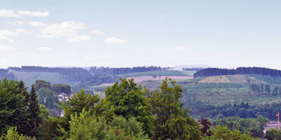
### Scenic Views and Open Meadows Around the 4 km (2.5 miles) mark, the trail opens up into a series of meadows. Here, you’ll be rewarded with panoramic views of the surrounding Märkischer Kreis region. The elevation gain becomes more noticeable in this section, but the effort is well worth it for the vistas. These meadows are often dotted with wildflowers in the spring and summer, adding a splash of color to the landscape.
### Historical Significance As you continue, you’ll come across several historical landmarks. One notable site is the remnants of an old watchtower, dating back to medieval times. This tower was part of a network used for communication and defense. Information plaques provide context and historical background, making it a great spot to take a break and learn about the region’s past.
### Navigating the Trail The trail is well-marked with signs and blazes, but it’s always a good idea to have a reliable navigation tool. HiiKER is highly recommended for this purpose, offering detailed maps and real-time GPS tracking to ensure you stay on course.
### Wildlife and Flora The latter part of the trail takes you through a more varied landscape, including small streams and rocky outcrops. This area is rich in flora, with various species of ferns and mosses carpeting the forest floor. You might also spot some of the region’s smaller mammals, such as hedgehogs and squirrels.
### Final Descent and Return The final descent brings you back through another section of forest before looping back to the trailhead. This part of the trail is less steep but can be slippery after rain, so good hiking boots are recommended. The loop nature of the trail means you’ll end up right where you started, making logistics simple.
### Getting There For those driving, set your GPS to Neuenrade, Märkischer Kreis, Germany. If using public transport, take a train to Neuenrade station and either walk or catch a local bus to the trailhead. The trail is well-signposted from the town, making it easy to find your way.
This trail offers a balanced mix of natural beauty, historical interest, and moderate physical challenge, making it a rewarding experience for hikers of all levels.
Reviews
User comments, reviews and discussions about the Atenaer Rundweg and Neuenrader Rundweg Loop, Germany.
0.0
average rating out of 5
0 rating(s)


