Download
Preview
Add to list
More
190.1 km
~11 days
4395 m
Multi-Day
“Embark on the Sauerland-Höhenflug Trail, a scenic hike through Germany's historic and biodiverse landscapes.”
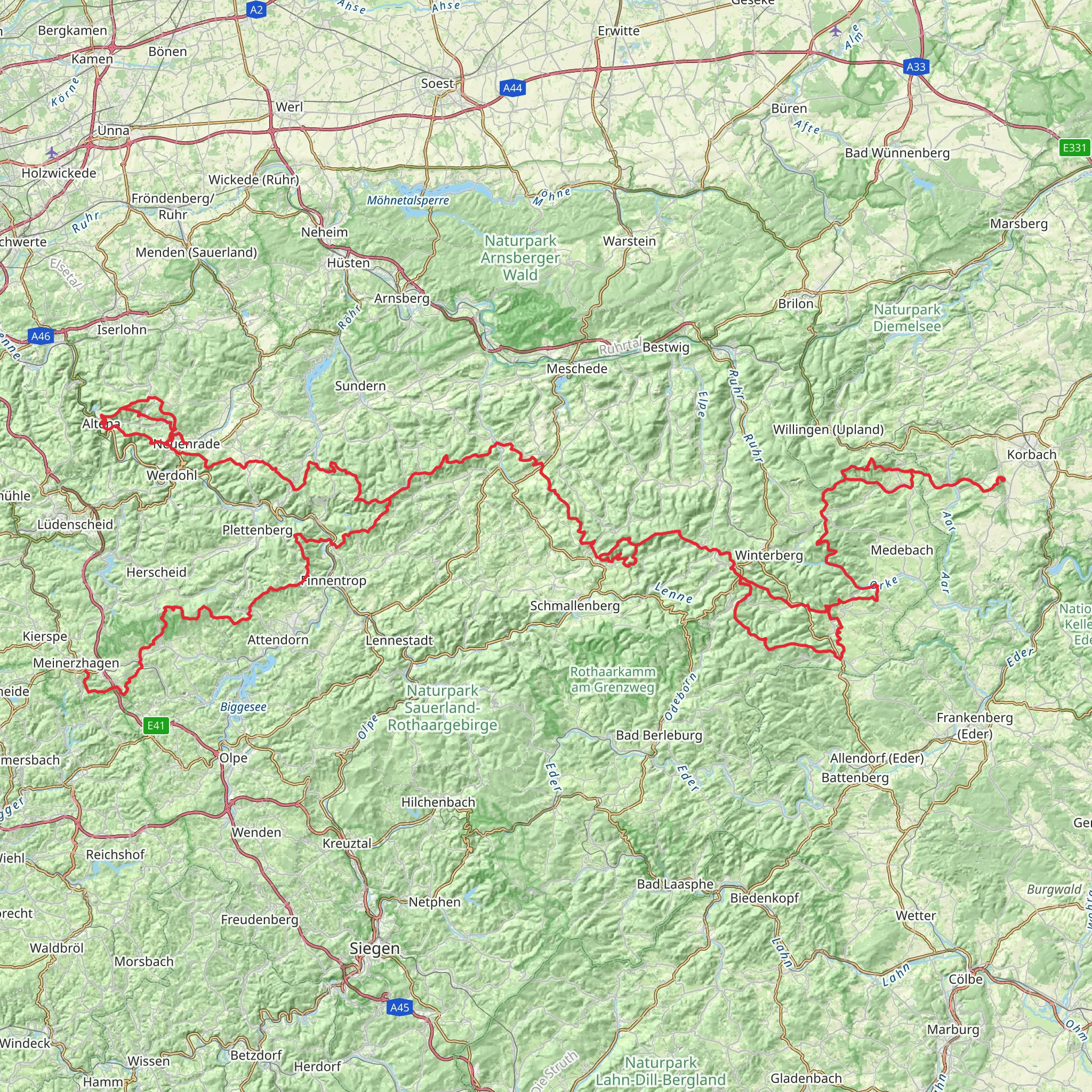
Embarking on the Sauerland-Höhenflug Wanderweg, hikers will traverse approximately 190 kilometers (about 118 miles) of varied landscapes, with an elevation gain of around 4300 meters (approximately 14,100 feet). This point-to-point trail begins near Märkischer Kreis, a region in Germany known for its rolling hills and dense forests.
Getting to the Trailhead
The starting point of the Sauerland-Höhenflug Wanderweg is accessible by both public transport and car. For those opting for public transportation, the nearest significant railway station is in the town of Altena. From there, local buses can take you closer to the trailhead. If driving, the trailhead is located near the town of Meinerzhagen, where you can find parking facilities to leave your vehicle before starting your hike.
Navigating the Trail
As you set out, ensure you have the HiiKER app downloaded for up-to-date trail maps and navigation. The app will be an invaluable tool for staying on course and locating points of interest along the way.
The Journey Through Nature
The Sauerland-Höhenflug offers a rich tapestry of natural wonders, from lush meadows and serene river valleys to dense woodlands and panoramic ridges. The trail is well-marked, guiding hikers through the picturesque Sauerland region, known for its biodiversity.
Wildlife and Flora
Keep an eye out for the diverse wildlife, including deer, foxes, and a variety of bird species. The trail also winds through areas of heathland, where the purple heather blooms in late summer, creating a stunning visual display.
Historical Landmarks
The Sauerland region is steeped in history, and the trail offers glimpses into the past with several castles and historic sites along the route. One of the notable landmarks is the Altena Castle, which is considered one of the most beautiful hill castles in Germany. The castle is located roughly 5 kilometers (about 3 miles) from the trailhead and is a must-visit for history enthusiasts.
Challenging Sections and Peaks
The trail includes several ascents and descents, with some of the more challenging sections found in the upland areas. One of the highest points is the Nordhelle peak, which offers expansive views of the surrounding landscape. The peak is situated about 50 kilometers (around 31 miles) from the start of the trail.
Accommodations and Resupply Points
Throughout the hike, there are numerous villages and towns where you can find accommodation and resupply. It's advisable to plan your stops in advance, especially during peak hiking seasons when places can get booked up quickly.
Weather Considerations
The weather in the Sauerland region can be unpredictable, so hikers should be prepared for sudden changes and pack accordingly. Layered clothing, waterproof gear, and sturdy hiking boots are recommended.
Trail Etiquette
Respect for nature is paramount on the Sauerland-Höhenflug. Stay on marked paths, carry out all trash, and be mindful of the Leave No Trace principles to preserve the trail for future hikers.
By preparing adequately and respecting the natural and historical significance of the region, hikers can fully enjoy the beauty and challenge of the Sauerland-Höhenflug Wanderweg.
Comments and Reviews
User comments, reviews and discussions about the Sauerland-Höhenflug Wanderweg, Germany.
4.33
average rating out of 5
3 rating(s)

