7.9 km
~2 hrs 2 min
285 m
“The Schwarzer Fuchs trail blends natural beauty, historical landmarks, and diverse wildlife for a rewarding hike.”
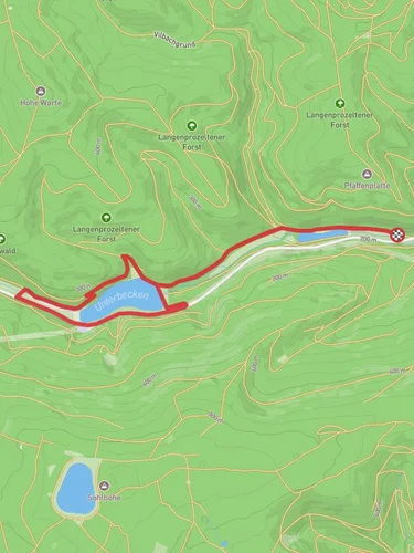
Starting near Main-Spessart, Germany, the Schwarzer Fuchs trail is an 8 km (approximately 5 miles) loop with an elevation gain of around 200 meters (656 feet). This medium-difficulty trail offers a rich blend of natural beauty, historical landmarks, and diverse wildlife, making it a rewarding experience for hikers.
### Getting There To reach the trailhead, you can either drive or use public transport. If driving, set your GPS to the nearest known address: Bahnhofstraße, 97828 Marktheidenfeld, Germany. From there, it's a short drive to the trailhead. For those using public transport, take a train to Marktheidenfeld station. From the station, local buses or a short taxi ride will get you to the starting point.
### Trail Overview The Schwarzer Fuchs trail begins with a gentle ascent through dense forests, offering a serene environment filled with the sounds of chirping birds and rustling leaves. The initial 2 km (1.2 miles) of the trail are relatively easy, allowing you to warm up and enjoy the lush greenery.
### Significant Landmarks Around the 3 km (1.9 miles) mark, you'll come across the ruins of an old watchtower, a remnant from the medieval period. This spot offers a glimpse into the region's historical significance, as these towers were once part of a network used for communication and defense.
Continuing on, the trail takes you through a series of meadows and small clearings. These open spaces are perfect for spotting local wildlife such as deer, foxes, and various bird species. Keep your camera handy, as these moments are often fleeting.
### Elevation Gain and Terrain As you approach the halfway point, the trail begins to climb more steeply. The next 2 km (1.2 miles) will see most of the 200 meters (656 feet) of elevation gain. The path can be rocky and uneven, so sturdy hiking boots are recommended. This section also offers panoramic views of the Main-Spessart region, making the climb well worth the effort.
### Flora and Fauna The Schwarzer Fuchs trail is home to a variety of plant species, including oak, beech, and pine trees. In the spring and summer months, the forest floor is carpeted with wildflowers, adding a splash of color to your hike. Wildlife is abundant, and you may encounter squirrels, rabbits, and a variety of bird species, including woodpeckers and owls.
### Navigation For navigation, it's advisable to use the HiiKER app, which provides detailed maps and real-time updates. The trail is well-marked, but having a reliable navigation tool can enhance your hiking experience and ensure you stay on the right path.
### Final Stretch The last 2 km (1.2 miles) of the trail are a gentle descent back to the starting point. This section winds through a picturesque valley, with a small stream running alongside the path. It's a perfect way to cool down and reflect on the hike as you make your way back.
### Historical Significance The Main-Spessart region has a rich history dating back to the medieval period. The area was once a strategic point for trade and defense, and remnants of this history can be seen along the trail. The old watchtower and other ruins serve as a reminder of the region's past, adding an educational element to your hike.
Whether you're a seasoned hiker or a casual walker, the Schwarzer Fuchs trail offers a balanced mix of natural beauty, historical intrigue, and physical challenge.
Reviews
User comments, reviews and discussions about the Schwarzer Fuchs, Germany.
4.0
average rating out of 5
2 rating(s)


