12.7 km
~2 hrs 49 min
174 m
“Explore Kronach's scenic beauty and historical richness on a delightful 13 km trail loop.”
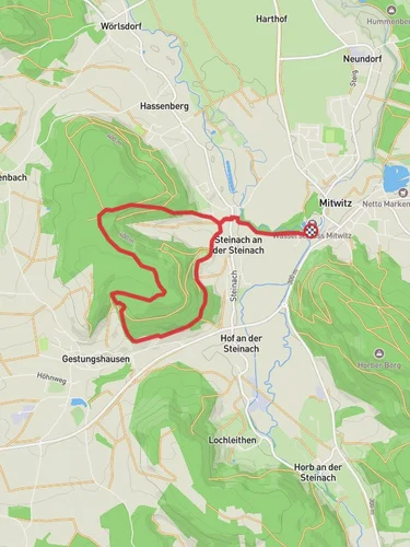
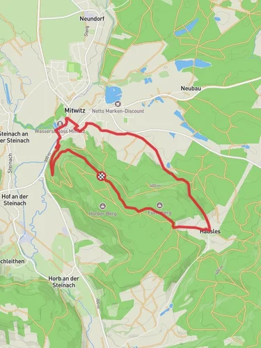
Starting near Kronach, Germany, the Muehlteich and Reginasee via Baechleiner Weg and Mitwitzer Runde trail offers a delightful 13 km (approximately 8 miles) loop with an elevation gain of around 100 meters (328 feet). This medium-difficulty trail is perfect for those looking to explore the scenic beauty and historical richness of the region.
### Getting There To reach the trailhead, you can either drive or use public transport. If driving, set your GPS to Kronach, Germany, and look for parking near the town center. For public transport, take a train to Kronach Bahnhof, which is well-connected to major cities like Nuremberg and Bamberg. From the train station, it's a short walk to the trailhead.
### Trail Overview The trail begins near the picturesque town of Kronach, known for its well-preserved medieval architecture and the imposing Rosenberg Fortress. As you start your hike, you'll quickly find yourself immersed in lush forests and serene landscapes.
### Key Landmarks and Sections
#### Muehlteich About 3 km (1.9 miles) into the hike, you'll reach Muehlteich, a tranquil pond surrounded by dense woodland. This is a great spot to take a short break and enjoy the natural beauty. The area is home to various bird species, so keep your binoculars handy if you're a bird-watching enthusiast.
#### Baechleiner Weg Continuing along Baechleiner Weg, the trail meanders through mixed forests and open meadows. This section is relatively flat, making it an easy and enjoyable walk. You'll cover approximately 5 km (3.1 miles) along this path before reaching the next significant landmark.
#### Reginasee At around the 8 km (5 miles) mark, you'll arrive at Reginasee, another serene body of water. This lake is slightly larger than Muehlteich and offers stunning reflections of the surrounding trees. It's an ideal spot for a picnic or a moment of quiet reflection.
### Historical Significance The region around Kronach is steeped in history. The town itself dates back to the 11th century and has been a significant cultural and economic center in Upper Franconia. The Rosenberg Fortress, visible from various points along the trail, is one of the largest and best-preserved fortresses in Germany. Built in the 13th century, it has served various roles, from a defensive stronghold to a residence for nobility.
### Wildlife and Flora The trail is rich in biodiversity. You'll encounter a variety of flora, including oak, beech, and pine trees. The underbrush is home to wildflowers, ferns, and mushrooms, especially in the wetter months. Wildlife sightings may include deer, foxes, and a variety of bird species such as woodpeckers and owls.
### Navigation For navigation, it's highly recommended to use HiiKER, which provides detailed maps and real-time updates. The trail is well-marked, but having a reliable navigation tool will ensure you stay on track and can fully enjoy the experience without any worries.
### Final Stretch The last 2 km (1.2 miles) of the trail loop back towards Kronach, offering a gentle descent through more forested areas. As you approach the town, you'll be treated to panoramic views of the surrounding countryside and the majestic Rosenberg Fortress, a fitting end to a rewarding hike.
This trail offers a perfect blend of natural beauty, historical intrigue, and moderate physical challenge, making it a must-visit for any hiking enthusiast exploring the Kronach region.
Reviews
User comments, reviews and discussions about the Muehlteich and Reginasee via Baechleiner Weg and Mitwitzer Runde, Germany.
0.0
average rating out of 5
0 rating(s)


