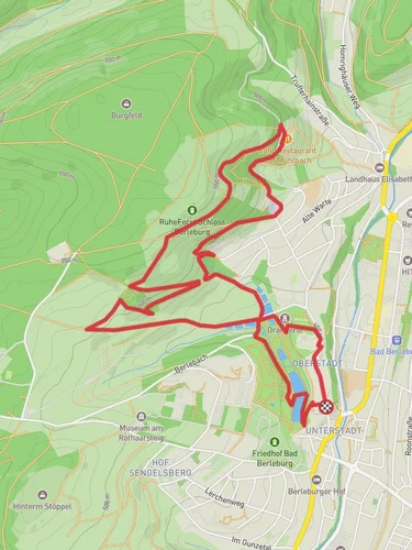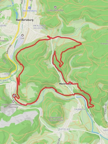
6.3 km
~1 hrs 39 min
236 m
“Immerse yourself in nature and history on the scenic, medium-difficulty Marchenspur and Heinz Suter Weg trail.”
Starting your hike near Kreis Siegen-Wittgenstein, Germany, the Marchenspur and Heinz Suter Weg trail offers a delightful 6 km (approximately 3.7 miles) out-and-back journey with an elevation gain of around 200 meters (656 feet). This medium-difficulty trail is perfect for those looking to immerse themselves in the natural beauty and historical richness of the region.
### Getting There To reach the trailhead, you can either drive or use public transport. If driving, set your GPS to the vicinity of Kreis Siegen-Wittgenstein. For those using public transport, the nearest significant landmark is the Siegen Central Station. From there, you can take a local bus or taxi to the trailhead.
### Trail Overview The trail begins with a gentle ascent, allowing you to ease into the hike. As you progress, the path becomes more challenging, with steeper sections that will test your endurance. The trail is well-marked, but it's always a good idea to have a navigation tool like HiiKER to ensure you stay on track.
### Nature and Wildlife The Marchenspur and Heinz Suter Weg trail is a haven for nature enthusiasts. The dense forests are home to a variety of flora and fauna. Keep an eye out for deer, foxes, and a plethora of bird species. The trail is particularly beautiful in the spring and autumn when the foliage is at its most vibrant.
### Significant Landmarks Around the 2 km (1.2 miles) mark, you'll come across a picturesque clearing that offers stunning views of the surrounding landscape. This is a great spot to take a break and soak in the scenery. Continuing on, you'll encounter several historical markers that provide insight into the region's past.
### Historical Significance The area around Kreis Siegen-Wittgenstein has a rich history dating back to medieval times. The trail itself is named after Heinz Suter, a local historian who dedicated his life to preserving the cultural heritage of the region. As you hike, you'll come across several plaques and information boards detailing the historical significance of various landmarks along the way.
### Elevation and Terrain The trail's elevation gain of 200 meters (656 feet) is spread out over the 6 km (3.7 miles), making it a manageable climb for most hikers. The terrain varies from well-trodden paths to rocky sections, so sturdy hiking boots are recommended. The highest point of the trail offers panoramic views that are well worth the effort.
### Final Stretch As you make your way back, the descent provides a welcome respite from the earlier climb. The return journey allows you to appreciate the trail from a different perspective, with the changing light offering new views and photo opportunities.
### Preparation Tips Given the medium difficulty rating, it's advisable to bring plenty of water, snacks, and a first-aid kit. Weather can be unpredictable, so check the forecast and dress in layers. The trail can be muddy after rain, so waterproof gear is a good idea.
By following these guidelines and being well-prepared, you'll have a rewarding and enjoyable hike on the Marchenspur and Heinz Suter Weg trail.
Reviews
User comments, reviews and discussions about the Marchenspur and Heinz Suter Weg, Germany.
5.0
average rating out of 5
1 rating(s)


