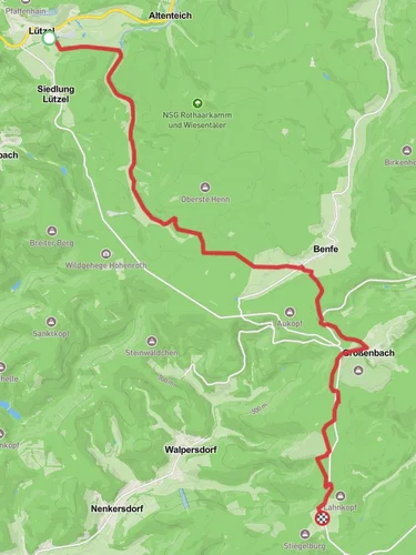
223.9 km
~10 day
3784 m
“Explore Germany's heart on the Ederhöhenweg, a scenic trek through history, nature's diversity, and captivating elevation shifts.”
Embarking on the Ederhöhenweg, hikers will traverse approximately 224 kilometers (about 139 miles) of varied landscapes, with an elevation gain of around 3700 meters (roughly 12,139 feet). This point-to-point trail is nestled in the heart of Germany, beginning near Kreis Siegen-Wittgenstein, a region known for its rich history and natural beauty.
Getting to the Trailhead
To reach the starting point of the Ederhöhenweg, hikers can utilize public transportation options such as trains and buses that service the area around Kreis Siegen-Wittgenstein. For those driving, there are parking facilities near the trailhead where you can leave your vehicle before embarking on your journey.
Navigating the Trail
As you set out on the Ederhöhenweg, it's advisable to use a reliable navigation tool like HiiKER to keep track of your progress and ensure you're following the correct path. The trail is well-marked, but having a digital map can be invaluable, especially in areas where the trail may become less distinct.
Landmarks and Scenery
The Ederhöhenweg offers a rich tapestry of landscapes, from dense forests and rolling hills to serene river valleys. One of the significant landmarks you'll encounter is the Eder River, which the trail frequently intersects, providing picturesque views and opportunities for rest along its banks.
Flora and Fauna
As you hike, you'll be immersed in a biodiverse environment. The trail passes through several nature reserves, where you can observe a variety of wildlife, including deer, birds of prey, and possibly even the elusive European wildcat. The changing seasons bring different flora to life, with wildflowers in spring and a kaleidoscope of foliage colors in autumn.
Historical Significance
The region surrounding the Ederhöhenweg is steeped in history. Hikers will pass through ancient towns and villages, some with origins dating back to the Middle Ages. The trail itself may lead you past old castles, fortresses, and remnants of historical trade routes, offering a glimpse into the area's past.
Trail Challenges
Though rated as medium difficulty, the Ederhöhenweg does present challenges with its varying elevation. Hikers should be prepared for steep ascents and descents, particularly in the sections where the trail climbs over the surrounding hills. Proper footwear and physical preparation are essential for a safe and enjoyable experience.
Preparation and Safety
Before setting out, ensure you have adequate supplies, including water, food, and appropriate clothing for changing weather conditions. It's also wise to inform someone of your hiking plans and expected return time. Check the weather forecast in advance and be prepared for the trail's length by planning overnight stops at local inns or designated camping areas.
Conclusion
By following these guidelines and being prepared for the journey ahead, hikers can fully enjoy the splendor and historical richness of the Ederhöhenweg. Whether you're seeking solitude, a physical challenge, or a deeper connection with nature, this trail offers a memorable experience through the heart of Germany's countryside.
Reviews
User comments, reviews and discussions about the Ederhöhenweg, Germany.
5.0
average rating out of 5
6 rating(s)


