5.1 km
~1 hrs 15 min
141 m
“Immerse in the serene beauty and history of Germany's Spechtenberg Loop, a scenic 5 km moderate hike.”
Starting near Kreis Paderborn, Germany, the Spechtenberg Loop is a delightful 5 km (approximately 3.1 miles) trail that offers a moderate challenge with an elevation gain of around 100 meters (328 feet). This loop trail is perfect for those looking to immerse themselves in the serene beauty of the German countryside while enjoying a manageable hike.
### Getting There To reach the trailhead, you can either drive or use public transport. If driving, set your GPS to the nearest known address: Paderborner Straße, 33154 Salzkotten, Germany. There is ample parking available near the trailhead. For those using public transport, take a train or bus to Salzkotten station, which is well-connected to major cities like Paderborn. From the station, it's a short taxi ride or a brisk walk to the trailhead.
### Trail Navigation The Spechtenberg Loop is well-marked, but it's always a good idea to have a reliable navigation tool. HiiKER is an excellent app for this purpose, providing detailed maps and real-time tracking to ensure you stay on course.
### Trail Highlights As you begin your hike, you'll notice the trail meandering through lush forests and open meadows. The initial part of the trail is relatively flat, making it a good warm-up for the moderate inclines that follow. About 1 km (0.6 miles) in, you'll start to ascend gently, gaining elevation as you move deeper into the forest.
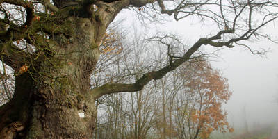
### Flora and Fauna The Spechtenberg Loop is rich in biodiversity. Keep an eye out for native wildlife such as deer, foxes, and a variety of bird species. The forested areas are home to oak, beech, and pine trees, providing a canopy of shade and a refreshing atmosphere. In the spring and summer months, the meadows burst into a riot of colors with wildflowers like daisies, poppies, and buttercups.
### Historical Significance This region of Kreis Paderborn has a rich history dating back to medieval times. As you hike, you'll come across several historical markers and information boards detailing the area's past. One notable landmark is the remnants of an old watchtower, approximately 3 km (1.9 miles) into the hike. This tower once served as a lookout point during the medieval period, offering a glimpse into the strategic importance of this region.
### Scenic Views Around the 4 km (2.5 miles) mark, you'll reach one of the highest points on the trail, offering panoramic views of the surrounding countryside. This is an excellent spot to take a break, enjoy a snack, and soak in the scenery. On clear days, you can see as far as the Teutoburg Forest, a historically significant area known for the Battle of the Teutoburg Forest in 9 AD.
### Final Stretch The last kilometer of the trail descends gradually, leading you back to the starting point. This section is particularly scenic, with the path winding through a picturesque valley dotted with small streams and rustic wooden bridges.
### Preparation Tips Given the moderate difficulty of the Spechtenberg Loop, it's advisable to wear sturdy hiking boots and bring plenty of water, especially during the warmer months. A light snack or picnic can enhance your experience, particularly at the scenic viewpoints. Always check the weather forecast before heading out and consider downloading the HiiKER app for real-time trail information and navigation assistance.
Enjoy your hike on the Spechtenberg Loop, a trail that beautifully combines natural beauty, historical intrigue, and a moderate physical challenge.
Reviews
User comments, reviews and discussions about the Spechtenberg Loop, Germany.
5.0
average rating out of 5
2 rating(s)


