13.9 km
~3 hrs 7 min
209 m
“Discover the Holtheim Rundweg A2: a 14 km hike through lush forests, meadows, and historical landmarks.”
Starting near Kreis Paderborn, Germany, the Holtheim Rundweg A2 is a loop trail that spans approximately 14 km (8.7 miles) with an elevation gain of around 200 meters (656 feet). This medium-difficulty trail offers a blend of natural beauty, historical landmarks, and diverse wildlife, making it a rewarding experience for hikers.
### Getting There To reach the trailhead, you can either drive or use public transport. If driving, set your GPS to Kreis Paderborn, Germany, and look for parking options near the starting point. For those using public transport, the nearest significant landmark is the Paderborn Hauptbahnhof (main train station). From there, you can take a local bus or taxi to the trailhead.
### Trail Navigation For navigation, it is highly recommended to use the HiiKER app, which provides detailed maps and real-time updates to ensure you stay on track.
### Trail Highlights
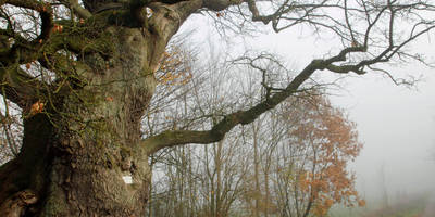
#### Natural Scenery The trail meanders through a variety of landscapes, including dense forests, open meadows, and rolling hills. Early in the hike, you'll encounter a lush forest area filled with oak and beech trees. As you progress, the trail opens up to expansive meadows where you can enjoy panoramic views of the surrounding countryside.
#### Wildlife Keep an eye out for local wildlife, including deer, foxes, and a variety of bird species. The forested sections are particularly rich in birdlife, so bringing a pair of binoculars could enhance your experience.
#### Historical Landmarks Around the 5 km (3.1 miles) mark, you'll come across the ruins of an old medieval watchtower. This site offers a glimpse into the region's historical significance, serving as a reminder of the area's strategic importance in centuries past. Information plaques provide context and historical details, making it a great spot for a short break.
### Elevation and Terrain The trail features a moderate elevation gain of around 200 meters (656 feet), spread out over the 14 km (8.7 miles). The initial ascent is gradual, making it accessible for hikers of varying skill levels. The highest point of the trail offers stunning views of the surrounding landscape, making the climb well worth the effort.
### Practical Tips - Footwear: Given the mixed terrain, sturdy hiking boots are recommended. - Weather: Check the weather forecast before you go, as conditions can change rapidly. - Water and Snacks: Bring sufficient water and snacks, as there are limited facilities along the trail. - Safety: Always let someone know your hiking plans and estimated return time.
### Flora and Fauna The trail is rich in diverse flora, including wildflowers that bloom in the spring and summer months. The forested areas are home to various types of moss and ferns, adding to the trail's lush, green ambiance.
### Final Stretch As you near the end of the loop, the trail descends gently back towards the starting point. This section offers a mix of shaded forest paths and open fields, providing a relaxing end to your hike.
By following these guidelines and using the HiiKER app for navigation, you'll be well-prepared to enjoy the Holtheim Rundweg A2 trail to its fullest.
Reviews
User comments, reviews and discussions about the Holtheim Rundweg A2, Germany.
5.0
average rating out of 5
2 rating(s)


