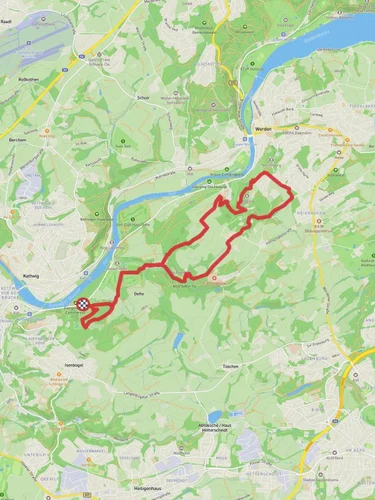
7.4 km
~1 hrs 42 min
139 m
“The Hustert, Vogelsang, and Wassermangel Loop is a scenic 7 km trail featuring diverse landscapes and historical landmarks.”
Starting near Kreis Mettmann, Germany, the Hustert, Vogelsang, and Wassermangel Loop is a delightful 7 km (4.35 miles) trail with an elevation gain of approximately 100 meters (328 feet). This loop trail is rated as medium difficulty, making it suitable for hikers with some experience.
### Getting There To reach the trailhead, you can drive or use public transport. If driving, set your GPS to Kreis Mettmann, Germany, and look for parking near the trailhead. For those using public transport, the nearest significant landmark is the Mettmann Stadtwald station. From there, it's a short walk to the trailhead.
### Trail Navigation For navigation, it's highly recommended to use the HiiKER app, which provides detailed maps and real-time updates. This will ensure you stay on the correct path and can easily find your way back if you take a detour.
### Trail Highlights The trail begins with a gentle ascent, offering a gradual introduction to the elevation gain. As you hike, you'll pass through a mix of dense forests and open meadows, providing a variety of landscapes to enjoy.
#### Hustert Section The first section, known as Hustert, is characterized by its lush greenery and towering trees. This part of the trail is relatively shaded, making it a pleasant walk even on warmer days. Keep an eye out for local wildlife, including deer and various bird species.
#### Vogelsang Section As you transition into the Vogelsang section, the trail opens up to more expansive views. This area is known for its rolling hills and picturesque scenery. The elevation gain here is more noticeable, but the well-maintained path makes it manageable. Vogelsang is also home to several historical landmarks, including remnants of old farmhouses and stone walls that date back several centuries.
#### Wassermangel Section The final section, Wassermangel, is perhaps the most diverse. Here, you'll encounter a mix of wetlands and dry areas, each with its unique flora and fauna. The name "Wassermangel" translates to "water shortage," but don't let that fool you; the area is rich in small streams and ponds. This section is particularly beautiful in the spring when wildflowers are in full bloom.
### Historical Significance The region around Kreis Mettmann has a rich history dating back to the Roman era. The trail itself passes near several historical sites, including ancient Roman roads and medieval structures. These landmarks offer a glimpse into the area's past and add an educational element to your hike.
### Wildlife and Nature The trail is home to a variety of wildlife, including deer, foxes, and numerous bird species. The diverse ecosystems along the trail support a wide range of plant life, from towering oaks to delicate wildflowers. Be sure to bring a camera to capture the natural beauty you'll encounter.
### Final Stretch As you near the end of the loop, the trail descends gently back towards the starting point. This final stretch offers a relaxing end to your hike, with more opportunities to enjoy the surrounding nature.
Whether you're a seasoned hiker or looking for a moderately challenging trail, the Hustert, Vogelsang, and Wassermangel Loop offers a rewarding experience with its diverse landscapes, historical landmarks, and abundant wildlife.
Reviews
User comments, reviews and discussions about the Hustert, Vogelsang and Wassermangel Loop, Germany.
4.0
average rating out of 5
3 rating(s)


