Download
Preview
Add to list
More
7.2 km
~1 hrs 41 min
149 m
Loop
“Experience a scenic, moderately challenging 7 km loop through lush forests and historic landmarks near Kreis Mettmann.”
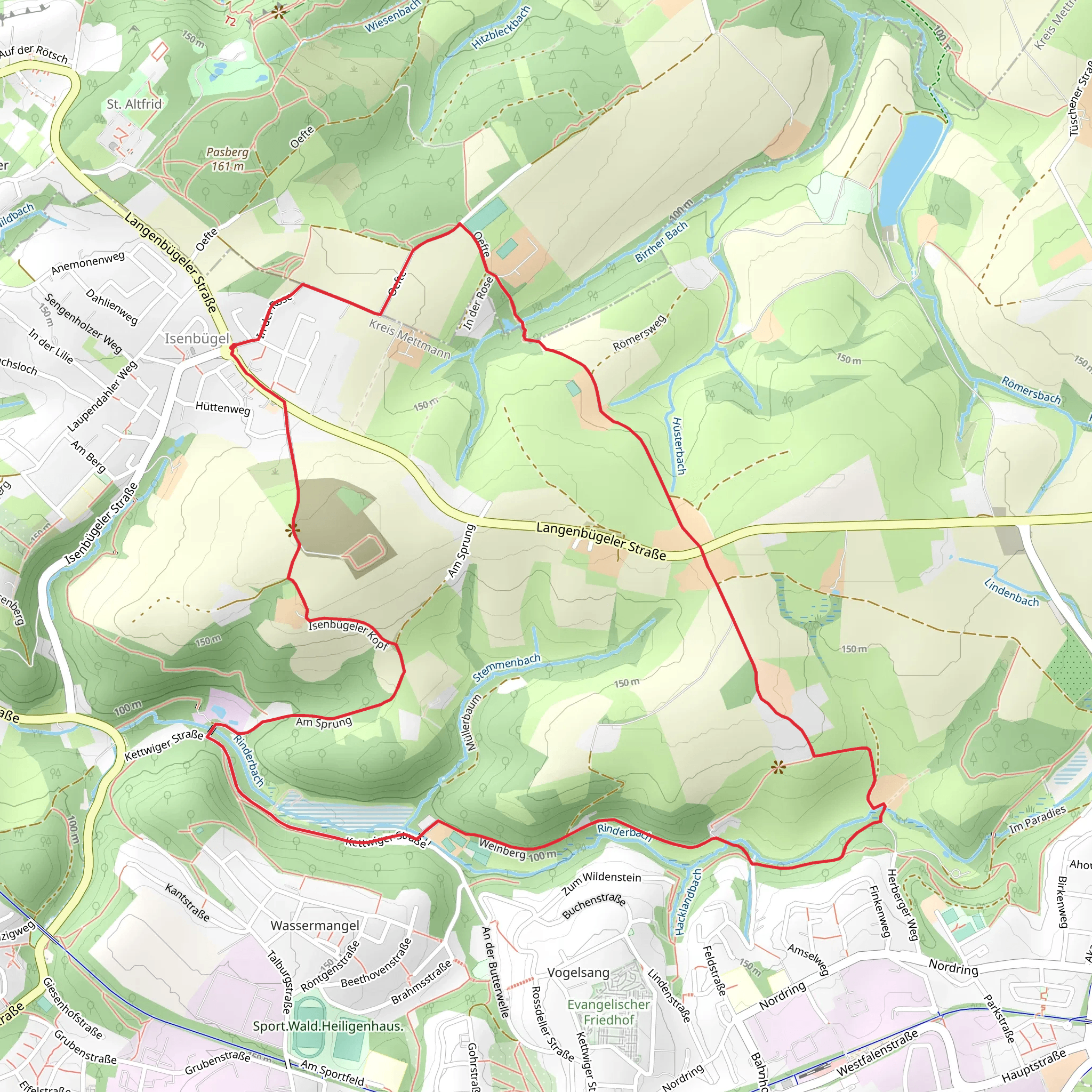
Starting near Kreis Mettmann, Germany, the Rinderbach via Isenbügel Rundweg is a delightful 7 km (4.3 miles) loop trail with an elevation gain of approximately 100 meters (328 feet). This trail is rated as medium difficulty, making it suitable for moderately experienced hikers.
Getting There To reach the trailhead, you can drive or use public transport. If driving, set your GPS to Kreis Mettmann, and look for parking options near the starting point. For public transport, take a train or bus to Mettmann station and then a local bus or taxi to the trailhead. The nearest significant landmark is the Mettmann Stadtwald, a large urban forest area.
Trail Overview The trail begins with a gentle ascent through lush forested areas, offering a serene start to your hike. As you progress, you'll encounter a mix of deciduous and coniferous trees, providing a rich tapestry of greenery. The initial 2 km (1.2 miles) are relatively easy, with a gradual elevation gain of about 50 meters (164 feet).
Key Landmarks and Points of Interest Around the 3 km (1.9 miles) mark, you'll come across the historic Isenbügel area. This region has a rich history dating back to medieval times, and you might spot remnants of old structures and pathways that were once vital trade routes. Keep an eye out for informational plaques that provide context about the historical significance of the area.
Wildlife and Nature The trail is home to a variety of wildlife, including deer, foxes, and numerous bird species. The Rinderbach stream, which the trail is named after, runs parallel to parts of the path, offering a tranquil soundtrack of flowing water. During spring and summer, the area is adorned with wildflowers, adding vibrant colors to your hike.
Navigation and Safety Navigating the trail is straightforward, but it's always a good idea to have a reliable navigation tool like HiiKER to ensure you stay on track. The trail is well-marked, but some sections can be slippery, especially after rain, so sturdy hiking boots are recommended.
Final Stretch The last 2 km (1.2 miles) of the trail loop back towards the starting point, with a gentle descent that offers panoramic views of the surrounding countryside. This section is particularly scenic during the fall when the foliage turns into a riot of colors.
Practical Tips - **Water and Snacks:** There are no facilities along the trail, so bring enough water and snacks. - **Weather:** Check the weather forecast before heading out, as conditions can change rapidly. - **Clothing:** Dress in layers to adapt to changing temperatures, and consider bringing a rain jacket.
This trail offers a perfect blend of natural beauty, historical intrigue, and moderate physical challenge, making it a rewarding experience for any hiker.
What to expect?
Activity types
Comments and Reviews
User comments, reviews and discussions about the Rinderbach via Isenbügel Rundweg, Germany.
4.33
average rating out of 5
3 rating(s)

