12.5 km
~2 hrs 55 min
255 m
“The Hitgenheierweg is a 13 km scenic loop in Germany, rich in nature, history, and wildlife.”
Starting near Kreis Höxter, Germany, the Hitgenheierweg is a captivating loop trail that spans approximately 13 kilometers (8 miles) with an elevation gain of around 200 meters (656 feet). This medium-difficulty trail offers a blend of natural beauty, historical landmarks, and diverse wildlife, making it a rewarding experience for hikers.
### Getting There To reach the trailhead, you can either drive or use public transport. If driving, set your GPS to Kreis Höxter, Germany, and look for parking options near the town center. For those using public transport, take a train or bus to Höxter station. From there, local buses or a short taxi ride will get you to the trailhead.
### Trail Navigation For navigation, the HiiKER app is highly recommended. It provides detailed maps and real-time updates, ensuring you stay on the right path throughout your hike.
### Trail Highlights
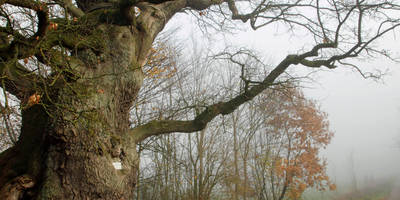
#### Nature and Wildlife The Hitgenheierweg takes you through a variety of landscapes, including dense forests, open meadows, and rolling hills. The trail is particularly beautiful in spring and autumn when the foliage is vibrant. Keep an eye out for local wildlife such as deer, foxes, and a variety of bird species. The diverse flora includes oak, beech, and pine trees, along with seasonal wildflowers that add a splash of color to the scenery.
#### Historical Significance The region around Kreis Höxter is steeped in history. As you hike, you'll come across several historical landmarks. One notable site is the Corvey Abbey, a UNESCO World Heritage site located about 5 kilometers (3 miles) from the trailhead. Founded in the 9th century, this former Benedictine monastery is a must-visit for history enthusiasts. Another significant landmark is the Old Town of Höxter, with its well-preserved medieval architecture and charming cobblestone streets.
### Trail Sections
#### Initial Ascent The trail begins with a gentle ascent through a mixed forest. This section is about 3 kilometers (1.9 miles) long and gains approximately 100 meters (328 feet) in elevation. The path is well-marked and relatively easy to navigate.
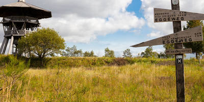
#### Mid-Trail Meadows After the initial climb, the trail opens up into expansive meadows. This section is relatively flat and offers panoramic views of the surrounding countryside. It's a great spot for a picnic or a short rest. This part of the trail covers about 4 kilometers (2.5 miles).
#### Final Descent The last section of the trail involves a gradual descent back into the forest, leading you back to the starting point. This part is around 6 kilometers (3.7 miles) long and includes a mix of forested paths and open areas.
### Practical Tips - Footwear: Sturdy hiking boots are recommended due to the varied terrain. - Weather: Check the weather forecast before you go, as conditions can change rapidly. - Water and Snacks: Carry enough water and snacks, especially if you plan to take breaks along the way. - Safety: Always let someone know your hiking plans and estimated return time.
The Hitgenheierweg offers a well-rounded hiking experience with its mix of natural beauty, historical landmarks, and diverse wildlife. Whether you're a seasoned hiker or a casual walker, this trail has something to offer for everyone.
Reviews
User comments, reviews and discussions about the Hitgenheierweg, Germany.
5.0
average rating out of 5
2 rating(s)


