5.7 km
~1 hrs 27 min
194 m
“The Kahler Asten and Hinterster Hoher Knochen Loop offers scenic vistas, rich biodiversity, and historical intrigue.”
Starting your hike near Hochsauerlandkreis, Germany, the Kahler Asten and Hinterster Hoher Knochen Loop is a delightful 6 km (approximately 3.7 miles) journey with an elevation gain of around 100 meters (328 feet). This loop trail is rated as medium difficulty, making it accessible for most hikers with a moderate level of fitness.
### Getting There To reach the trailhead, you can drive or use public transport. If driving, set your GPS to the nearest known address, which is the Kahler Asten, a well-known mountain in the region. For those using public transport, the nearest significant landmark is the Winterberg train station. From there, you can take a local bus or taxi to the Kahler Asten area.
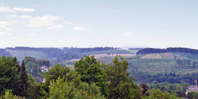
### Trail Highlights The trail begins near the Kahler Asten, one of the highest peaks in the Sauerland region, standing at 841 meters (2,759 feet). This area is renowned for its panoramic views and is a popular spot for both hikers and nature enthusiasts. As you start your hike, you'll be greeted by lush forests and open meadows, offering a serene and picturesque setting.
### Flora and Fauna The trail is rich in biodiversity. You’ll encounter a variety of plant species, including beech and spruce trees. During spring and summer, the meadows are adorned with wildflowers, adding a splash of color to the landscape. Keep an eye out for local wildlife such as deer, foxes, and a variety of bird species. Birdwatchers will particularly enjoy the chance to spot woodpeckers and other native birds.
### Historical Significance The region has a rich history, with the Kahler Asten being a significant landmark for centuries. Historically, it served as a lookout point due to its elevation. The area around the trail also has remnants of ancient settlements and old trade routes, adding a layer of historical intrigue to your hike.
### Key Landmarks - Kahler Asten Weather Station: Approximately 1 km (0.6 miles) into the hike, you’ll come across the Kahler Asten weather station. This station is one of the oldest in Germany and provides valuable meteorological data. It’s also a great spot to take a break and enjoy the views. - Hinterster Hoher Knochen: As you continue, you’ll reach the Hinterster Hoher Knochen, another notable peak in the area. The ascent is gradual, making it manageable for most hikers. From the top, you’ll have stunning views of the surrounding valleys and forests.
### Navigation To ensure you stay on track, it’s advisable to use a reliable navigation tool like HiiKER. The app provides detailed maps and real-time updates, helping you navigate the trail with ease.
### Final Stretch The final part of the loop takes you through more dense forest areas before gradually descending back towards the starting point. The trail is well-marked, but always keep an eye out for trail markers to stay on the correct path.
### Practical Tips - Footwear: Wear sturdy hiking boots as the trail can be uneven in places. - Weather: Check the weather forecast before you go. The region can be prone to sudden changes in weather, especially at higher elevations. - Supplies: Carry enough water and snacks. There are few facilities along the trail, so it’s best to be self-sufficient. - Clothing: Dress in layers. The temperature can vary, especially as you gain elevation.
This loop offers a perfect blend of natural beauty, historical significance, and moderate physical challenge, making it a rewarding experience for any hiker.
Reviews
User comments, reviews and discussions about the Kahler Asten and Hinterster Hoher Knochen Loop, Germany.
5.0
average rating out of 5
10 rating(s)


