8.5 km
~2 hrs 3 min
218 m
“Experience natural beauty and historical intrigue on the 8 km Hansenweg and Mollseifener Rundweg trail in Germany.”
Starting near Hochsauerlandkreis, Germany, the Hansenweg and Mollseifener Rundweg is an 8 km (approximately 5 miles) loop trail with an elevation gain of around 200 meters (656 feet). This medium-difficulty trail offers a blend of natural beauty and historical significance, making it a rewarding experience for hikers of various skill levels.
### Getting There To reach the trailhead, you can drive or use public transport. If driving, set your GPS to Hochsauerlandkreis, Germany. For those using public transport, the nearest major town is Winterberg, which is well-connected by train. From Winterberg, you can take a local bus to the trailhead area. The nearest significant landmark to the trailhead is the Kahler Asten, one of the highest peaks in the region.
### Trail Navigation For navigation, HiiKER is highly recommended to ensure you stay on track and make the most of your hike. The trail is well-marked, but having a reliable navigation tool can provide additional peace of mind.
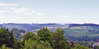
### Trail Highlights The trail begins with a gentle ascent through dense forest, offering a serene start to your hike. After about 1 km (0.6 miles), you'll reach a clearing with panoramic views of the surrounding Hochsauerlandkreis region. This is an excellent spot for a quick rest and some photos.
### Flora and Fauna As you continue, you'll traverse through mixed woodlands rich in biodiversity. Keep an eye out for native wildlife such as deer, foxes, and a variety of bird species. The forest floor is often carpeted with wildflowers in the spring and summer, adding a splash of color to your hike.
### Historical Significance Around the 4 km (2.5 miles) mark, you'll come across remnants of old mining operations. This area was historically significant for its iron ore mining, which dates back to the 18th century. Informational plaques provide insights into the region's industrial past, making this a great educational stop.
### Scenic Views The trail then leads you to a series of rolling meadows, offering expansive views of the Sauerland mountains. This section is relatively flat, allowing you to catch your breath and enjoy the scenery. The meadows are particularly stunning in the late summer when they are in full bloom.
### Final Stretch As you approach the final 2 km (1.2 miles) of the loop, the trail descends back into the forest. This section can be a bit steep, so watch your footing, especially if the ground is wet. The descent brings you back to the starting point, completing the loop.
### Practical Tips - Wear sturdy hiking boots, as the trail can be uneven in places. - Bring plenty of water and snacks, especially if you plan to take your time exploring the historical sites. - Check the weather forecast before you go; the trail can be slippery after rain. - Use HiiKER for real-time navigation and updates on trail conditions.
This trail offers a perfect mix of natural beauty, wildlife, and historical intrigue, making it a must-visit for any hiking enthusiast.
Reviews
User comments, reviews and discussions about the Hansenweg and Mollseifener Rundweg, Germany.
5.0
average rating out of 5
2 rating(s)


