12.2 km
~3 hrs 38 min
713 m
“A captivating 12 km loop trail near Esslingen, blending natural beauty, history, and panoramic views.”
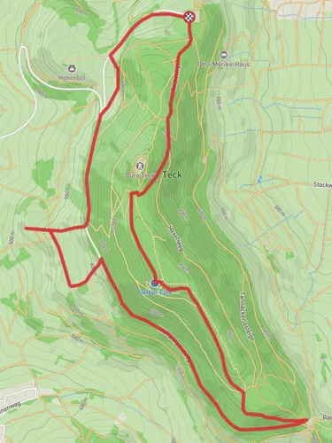
Starting near Esslingen, Germany, the Breitenstein and Teckberg via Hochgehadelt trail is a captivating 12 km (7.5 miles) loop with an elevation gain of approximately 700 meters (2,300 feet). This medium-difficulty trail offers a blend of natural beauty, historical landmarks, and panoramic views, making it a rewarding experience for hikers.
### Getting There To reach the trailhead, you can either drive or use public transport. If driving, head towards Esslingen and follow signs to the nearby parking areas. For those using public transport, take a train to Esslingen station and then a local bus to the trailhead. The nearest significant landmark to the trailhead is the Esslingen Castle, a historical site worth visiting before or after your hike.
### Trail Overview The trail begins with a gentle ascent through lush forests, offering a serene start to your journey. As you progress, the path becomes steeper, leading you to the first significant landmark, the Breitenstein. This rocky outcrop provides stunning views of the Swabian Alps and the surrounding countryside. At around 3 km (1.9 miles) into the hike, you'll have gained approximately 300 meters (984 feet) in elevation.
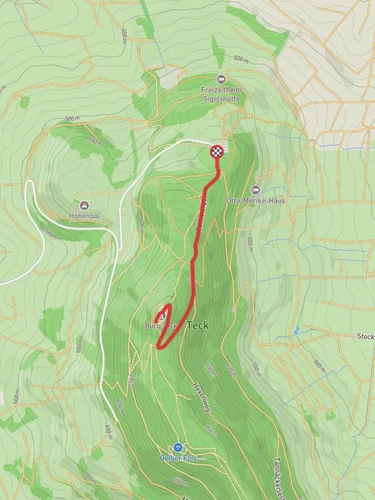
### Historical Significance The region is rich in history, with the Teckberg area being particularly noteworthy. The Teck Castle, located near the summit, dates back to the 12th century and offers a glimpse into medieval architecture. The castle ruins are accessible and provide an excellent spot for a break, allowing you to soak in the historical ambiance and panoramic views.
### Flora and Fauna As you continue along the trail, you'll traverse diverse landscapes, from dense forests to open meadows. The area is home to a variety of wildlife, including deer, foxes, and numerous bird species. In spring and summer, the meadows are adorned with wildflowers, adding a splash of color to your hike.
### Navigation and Safety The trail is well-marked, but it's always a good idea to have a reliable navigation tool. HiiKER is recommended for its detailed maps and real-time updates. Ensure you have adequate water and snacks, as there are limited facilities along the route. The trail can be slippery in wet conditions, so appropriate footwear is essential.
### Final Stretch The descent from Teckberg is gradual, taking you through more forested areas and eventually looping back to the starting point. The final 3 km (1.9 miles) are relatively easy, allowing you to enjoy the natural surroundings at a leisurely pace.
This trail offers a perfect blend of physical challenge, natural beauty, and historical intrigue, making it a must-visit for any hiking enthusiast.
Reviews
User comments, reviews and discussions about the Breitenstein and Teckberg via Hochgehadelt, Germany.
0.0
average rating out of 5
0 rating(s)


