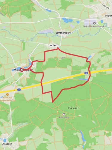
7.6 km
~1 hrs 48 min
178 m
“Explore lush landscapes, historical ruins, and panoramic views on this scenic 8 km Lonnerstadt loop trail.”
Starting near the charming town of Lonnerstadt in the Erlangen-Höchstadt district of Germany, this 8 km (approximately 5 miles) loop trail offers a delightful mix of natural beauty and historical intrigue. With an elevation gain of around 100 meters (328 feet), it is rated as a medium difficulty hike, making it accessible for most hikers with a moderate level of fitness.
### Getting There To reach the trailhead, you can drive or use public transport. If driving, set your GPS to Lonnerstadt, Erlangen-Höchstadt, Germany. There is ample parking available near the town center. For those using public transport, take a train to Erlangen and then a local bus to Lonnerstadt. The bus stop is conveniently located near the trailhead.
### Trail Overview The trail begins in the heart of Lonnerstadt, a quaint town known for its picturesque half-timbered houses and serene countryside. As you start your hike, you'll immediately be greeted by the lush greenery of the surrounding fields and forests. The first kilometer (0.6 miles) is relatively flat, allowing you to ease into the hike while enjoying the pastoral landscapes.
### Historical Significance Around the 2 km (1.2 miles) mark, you'll come across the remnants of an old mill, a testament to the region's agricultural past. This area was historically significant for its grain production, and the mill played a crucial role in the local economy. Take a moment to explore the ruins and imagine the bustling activity that once took place here.
### Nature and Wildlife As you continue, the trail gradually ascends into a mixed forest, offering a canopy of oak, beech, and pine trees. This section, between 3 km and 5 km (1.8 to 3.1 miles), is particularly rich in wildlife. Keep an eye out for deer, foxes, and a variety of bird species, including woodpeckers and owls. The forest floor is often carpeted with wildflowers in the spring and summer, adding a splash of color to your hike.
### Scenic Views Around the 6 km (3.7 miles) point, the trail reaches its highest elevation. Here, you'll be rewarded with panoramic views of the Franconian countryside. On a clear day, you can see as far as the distant hills of the Steigerwald Nature Park. This is an excellent spot to take a break, have a snack, and soak in the scenery.
### Final Stretch The descent begins shortly after, leading you through more open fields and past a few small farms. The final 2 km (1.2 miles) are relatively easy, allowing you to cool down as you make your way back to Lonnerstadt. Along this stretch, you'll pass by a charming little chapel, a perfect spot for a moment of reflection or a quick photo.
### Navigation For navigation, it's highly recommended to use the HiiKER app, which provides detailed maps and real-time updates to ensure you stay on track. The trail is well-marked, but having a reliable navigation tool can enhance your hiking experience.
This loop trail offers a perfect blend of natural beauty, historical landmarks, and wildlife, making it a rewarding hike for anyone looking to explore the scenic and historical richness of the Erlangen-Höchstadt region.
Reviews
User comments, reviews and discussions about the Rundweg Lonnerstadt Loop, Germany.
0.0
average rating out of 5
0 rating(s)


