Jellinghausen to Volkssternwarte Ennepetal Loop via Jellinghausen Weg
8.7 km
~2 hrs 16 min
318 m
“Explore the captivating 9 km Jellinghausen to Volkssternwarte Loop, blending scenic beauty, historical intrigue, and moderate challenge.”
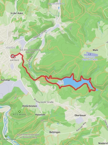
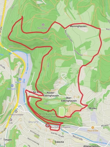
Starting near Ennepe-Ruhr-Kreis, Germany, the Jellinghausen to Volkssternwarte Ennepetal Loop via Jellinghausen Weg is a captivating 9 km (approximately 5.6 miles) trail with an elevation gain of around 300 meters (984 feet). This loop trail is rated as medium difficulty, making it suitable for moderately experienced hikers.
### Getting There To reach the trailhead, you can drive or use public transport. If driving, set your GPS to Jellinghausen, Ennepe-Ruhr-Kreis, Germany. For those using public transport, the nearest major town is Ennepetal, which is well-connected by train. From Ennepetal, you can take a local bus or taxi to Jellinghausen.
### Trail Overview The trail begins in the quaint village of Jellinghausen, a picturesque starting point surrounded by lush greenery. As you set off, you'll quickly find yourself immersed in the serene beauty of the German countryside. The initial part of the trail is relatively flat, allowing you to ease into the hike.
### Key Landmarks and Points of Interest - Jellinghausen Weg: About 2 km (1.2 miles) into the hike, you'll join the Jellinghausen Weg, a historic path that has been used for centuries. This section of the trail is rich in history, with remnants of old stone markers and ancient trees lining the path. - Ennepe River: Around the 4 km (2.5 miles) mark, you'll encounter the Ennepe River. This is a great spot to take a short break and enjoy the tranquil sounds of flowing water. The riverbanks are often teeming with local wildlife, including various bird species and small mammals. - Volkssternwarte Ennepetal: At approximately 6 km (3.7 miles), you'll reach the Volkssternwarte Ennepetal, an astronomical observatory. This landmark offers a unique opportunity to learn about the stars and planets. The observatory occasionally hosts public viewing nights, so check their schedule if you're interested in stargazing.
### Flora and Fauna The trail is abundant with diverse flora and fauna. Depending on the season, you might see wildflowers, mushrooms, and a variety of trees such as oak, beech, and pine. Wildlife sightings can include deer, foxes, and numerous bird species. Keep your eyes peeled and your camera ready.
### Elevation and Terrain The trail features a gradual elevation gain of 300 meters (984 feet), with the most significant climbs occurring between the 5 km (3.1 miles) and 7 km (4.3 miles) marks. The terrain varies from well-trodden paths to more rugged sections, so sturdy hiking boots are recommended. Some parts of the trail can be muddy, especially after rain, so be prepared for potentially slippery conditions.
### Navigation For navigation, it's advisable to use HiiKER, which provides detailed maps and real-time updates. The trail is well-marked, but having a reliable navigation tool can enhance your hiking experience and ensure you stay on track.
### Historical Significance The region around Ennepe-Ruhr-Kreis has a rich history dating back to medieval times. The Jellinghausen Weg itself is a testament to the area's long-standing human activity. The trail passes through areas that were once significant trade routes and settlements, offering a glimpse into the past.
### Final Stretch As you loop back towards Jellinghausen, the final 2 km (1.2 miles) are relatively easy, allowing you to cool down and reflect on the journey. The trail ends where it began, in the charming village of Jellinghausen, where you can relax and perhaps enjoy a meal at a local eatery.
This trail offers a perfect blend of natural beauty, historical intrigue, and moderate physical challenge, making it a rewarding experience for any hiker.
Reviews
User comments, reviews and discussions about the Jellinghausen to Volkssternwarte Ennepetal Loop via Jellinghausen Weg, Germany.
5.0
average rating out of 5
2 rating(s)


