12.6 km
~3 hrs 16 min
452 m
“Explore the captivating 13-km Angelweiher via Pfaelzerwald Weisser Punkt trail, blending natural beauty and historical intrigue.”
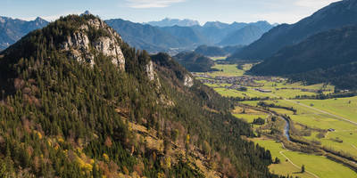
Starting near Donnersbergkreis, Germany, the Angelweiher via Pfaelzerwald Weisser Punkt trail is a captivating loop trail that spans approximately 13 kilometers (8 miles) with an elevation gain of around 400 meters (1,312 feet). This medium-difficulty hike offers a blend of natural beauty, historical significance, and a variety of landscapes that will keep any hiker engaged.
### Getting There To reach the trailhead, you can either drive or use public transport. If driving, set your GPS to Donnersbergkreis, and look for parking near the village of Dannenfels. For those using public transport, take a train to Kirchheimbolanden and then a local bus to Dannenfels. The trailhead is conveniently located near the village, making it easily accessible.
### Trail Navigation For navigation, it is highly recommended to use the HiiKER app, which provides detailed maps and real-time updates to ensure you stay on the right path.
### Trail Highlights #### Angelweiher Pond One of the first significant landmarks you'll encounter is the Angelweiher Pond, located about 3 kilometers (1.9 miles) into the hike. This serene pond is a great spot for a short break, offering picturesque views and a chance to spot local wildlife such as ducks and herons.
#### Pfaelzerwald Forest As you continue, you'll enter the Pfaelzerwald, or Palatinate Forest, a sprawling woodland area known for its dense trees and diverse flora. The forest is home to a variety of wildlife, including deer, wild boar, and numerous bird species. The trail through the forest is well-marked but can be uneven, so sturdy hiking boots are recommended.
#### Historical Significance Around the halfway point, approximately 6.5 kilometers (4 miles) in, you'll come across remnants of historical significance. The area around Donnersbergkreis has a rich history dating back to Roman times. Look out for ancient ruins and old stone markers that tell the story of the region's past.
### Elevation and Terrain The trail features a steady elevation gain of about 400 meters (1,312 feet), with some steep sections that can be challenging. The highest point of the trail offers panoramic views of the surrounding countryside, making the climb well worth the effort. The terrain varies from forest paths to rocky sections, so be prepared for a bit of everything.
### Flora and Fauna Throughout the hike, you'll encounter a variety of plant species, from towering oaks and pines to colorful wildflowers in the spring and summer months. The diverse ecosystem supports a range of animals, so keep your eyes peeled for sightings of red squirrels, foxes, and a variety of birdlife.
### Final Stretch As you near the end of the loop, the trail descends gradually back towards Dannenfels. This section offers more open views and meadows, providing a relaxing end to your hike. The final 2 kilometers (1.2 miles) are relatively easy, allowing you to cool down and reflect on the journey.
### Practical Tips - Water and Snacks: Make sure to bring enough water and snacks, as there are limited facilities along the trail. - Weather: Check the weather forecast before heading out, as conditions can change rapidly in the forest. - Clothing: Dress in layers, as the forest can be cool even in summer, and bring a rain jacket just in case.
This trail offers a perfect mix of natural beauty, historical intrigue, and physical challenge, making it a must-do for any hiking enthusiast visiting the Donnersbergkreis region.
Reviews
User comments, reviews and discussions about the Angelweiher via Pfaelzerwald Weisser Punkt, Germany.
4.0
average rating out of 5
3 rating(s)


