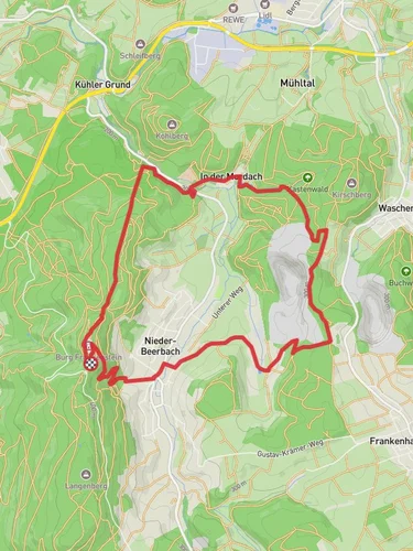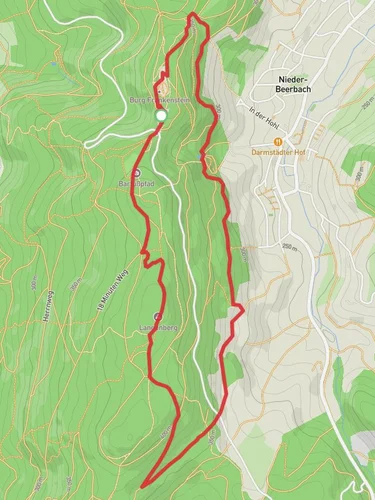
9.8 km
~2 hrs 24 min
272 m
“Explore scenic beauty and history on the 10 km Verbindungsweg and Ortsrundwanderweg Waschenbach trail in Germany.”
Starting near Darmstadt-Dieburg, Germany, the Verbindungsweg and Ortsrundwanderweg Waschenbach trail offers a delightful 10 km (6.2 miles) loop with an elevation gain of approximately 200 meters (656 feet). This medium-difficulty trail is perfect for those looking to explore the scenic beauty and historical richness of the region.
### Getting There To reach the trailhead, you can either drive or use public transport. If driving, set your GPS to the vicinity of Waschenbach, a small village near Darmstadt-Dieburg. For public transport, take a train to Darmstadt Hauptbahnhof and then a bus to Waschenbach. The bus stop is conveniently located near the trailhead, making it easy to start your hike.
### Trail Overview The trail begins in the charming village of Waschenbach, known for its picturesque half-timbered houses and serene countryside. As you start your hike, you'll be greeted by a gentle ascent through mixed forests, offering a cool and shaded environment, especially pleasant during the warmer months.
### Key Landmarks and Nature Around the 2 km (1.2 miles) mark, you'll come across the first significant landmark: the Waschenbach Chapel. This quaint chapel, dating back to the 18th century, is a perfect spot for a short break and some photos. Continuing on, the trail meanders through lush meadows and dense woodlands, providing ample opportunities to spot local wildlife such as deer, foxes, and a variety of bird species.
### Historical Significance The region around Darmstadt-Dieburg has a rich history, with evidence of human settlement dating back to the Roman era. As you hike, you'll notice several informational plaques detailing the historical significance of the area, including ancient Roman roads and medieval trade routes that once crisscrossed this landscape.
### Navigation and Terrain The trail is well-marked, but it's always a good idea to have a reliable navigation tool. HiiKER is highly recommended for this purpose, offering detailed maps and real-time GPS tracking to ensure you stay on course. The terrain varies from well-maintained paths to more rugged sections, so sturdy hiking boots are advisable.
### Midpoint and Elevation At approximately the 5 km (3.1 miles) midpoint, you'll reach the highest elevation of the trail, offering panoramic views of the surrounding countryside. This is an ideal spot for a picnic, allowing you to take in the breathtaking scenery before beginning your descent.
### Flora and Fauna The descent takes you through a diverse range of ecosystems, from dense forests to open fields. Keep an eye out for wildflowers in the spring and summer months, and enjoy the vibrant foliage in the fall. The area is also home to several species of mushrooms, so foraging enthusiasts might find some interesting specimens along the way.
### Final Stretch As you approach the final stretch of the trail, you'll pass through the outskirts of Waschenbach, where you can enjoy the sight of traditional German farmhouses and perhaps even stop by a local café for a well-deserved treat. The loop concludes back at the starting point, making it easy to find your way back to your car or the bus stop.
This trail offers a perfect blend of natural beauty, historical intrigue, and moderate physical challenge, making it a rewarding experience for hikers of all levels.
Reviews
User comments, reviews and discussions about the Verbindungsweg and Ortsrundwanderweg Waschenbach, Germany.
5.0
average rating out of 5
2 rating(s)


