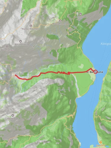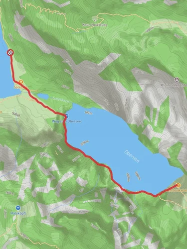
Wimbachgrieshütte to Diessbachscharte via AV Weg
8.0 km
~3 hrs 21 min
1061 m
“Embark on a scenic and challenging hike through Berchtesgadener Land's stunning valleys, diverse flora, and historical paths.”
Starting your hike near Berchtesgadener Land, Germany, the trailhead for the Wimbachgrieshütte to Diessbachscharte via AV Weg is easily accessible. If you're traveling by public transport, you can take a train to Berchtesgaden Hauptbahnhof and then a bus to Ramsau bei Berchtesgaden. From there, a short taxi ride or a local bus will bring you to the Wimbachbrücke, the nearest significant landmark to the trailhead. If you're driving, parking is available at the Wimbachbrücke parking lot.
### Initial Ascent and Terrain
The trail begins with a steady ascent through the Wimbachgries Valley, a stunning glacial valley characterized by its rugged terrain and dramatic rock formations. The initial 2 km (1.2 miles) will see you gaining approximately 300 meters (984 feet) in elevation. The path is well-marked and relatively straightforward, but be prepared for some rocky sections. As you ascend, you'll be surrounded by the towering peaks of the Berchtesgaden Alps, offering breathtaking views and ample photo opportunities.
### Flora and Fauna
As you continue your hike, you'll traverse through diverse ecosystems. The lower sections of the trail are lush with alpine meadows, where you might spot wildflowers such as edelweiss and gentian. Keep an eye out for wildlife; chamois and marmots are common in this region. Birdwatchers will also be delighted by the presence of golden eagles and alpine choughs.
### Midway Point: Wimbachgrieshütte
Around the 4 km (2.5 miles) mark, you'll reach the Wimbachgrieshütte, a mountain hut that serves as a perfect spot for a rest. Here, you can refuel with some traditional Bavarian snacks and enjoy the panoramic views. The hut is also a good place to check your progress on HiiKER and ensure you're on the right path.
### Steeper Climb to Diessbachscharte
Leaving the Wimbachgrieshütte, the trail becomes steeper and more challenging. Over the next 4 km (2.5 miles), you'll gain an additional 700 meters (2,297 feet) in elevation. The path narrows and becomes more rugged, requiring careful footing. This section is particularly scenic, with cascading streams and alpine flora lining the route. The final push to Diessbachscharte is the most strenuous, but the effort is well worth it.
### Historical Significance
The Berchtesgadener Land region is steeped in history. During World War II, the area was part of the Obersalzberg complex, a retreat for Nazi leaders. Today, the region is a symbol of peace and natural beauty, attracting hikers from around the world. The trail itself has been used for centuries by shepherds and traders, adding a layer of historical depth to your hike.
### Reaching Diessbachscharte
Upon reaching Diessbachscharte, you'll be rewarded with sweeping views of the surrounding peaks and valleys. This mountain pass sits at an elevation of approximately 2,200 meters (7,218 feet) and offers a stunning vantage point. Take a moment to soak in the scenery and perhaps consult HiiKER for nearby trails if you're looking to extend your adventure.
### Descent and Return
From Diessbachscharte, you can either return the way you came or continue on to other connecting trails. If you choose to descend, be mindful of the steep and rocky sections, especially if the weather has turned. The descent offers a different perspective on the landscape, with the changing light casting new shadows and highlights on the rugged terrain.
This trail is a rewarding journey through one of Germany's most picturesque regions, offering a mix of natural beauty, challenging terrain, and historical significance.
Reviews
User comments, reviews and discussions about the Wimbachgrieshütte to Diessbachscharte via AV Weg, Germany.
0.0
average rating out of 5
0 rating(s)


