Download
Preview
Add to list
More
11.5 km
~3 hrs 54 min
968 m
Point-to-Point
“Hike a scenic 12-kilometer trail through forests, alpine meadows, and historic landmarks in Berchtesgadener Land.”
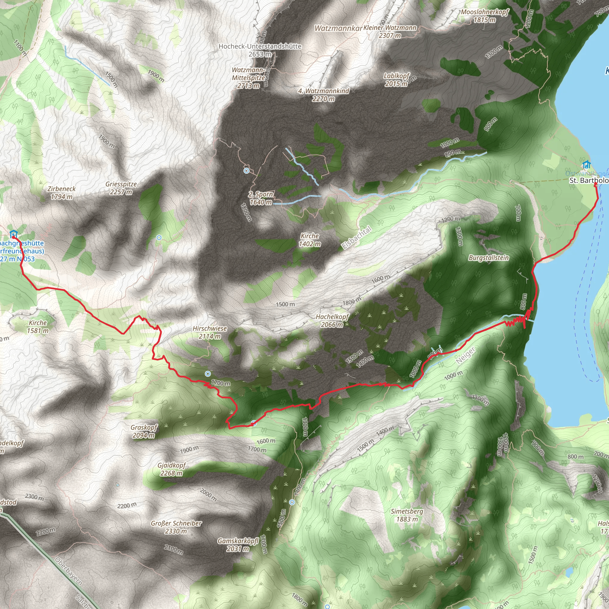
Starting your journey near Berchtesgadener Land, Germany, this trail spans approximately 12 kilometers (7.5 miles) with an elevation gain of around 900 meters (2,950 feet). The trailhead is accessible by both public transport and car. If you're using public transport, you can take a bus or train to Berchtesgaden, which is well-connected to major cities like Munich and Salzburg. From Berchtesgaden, local buses or taxis can take you to the trailhead. If driving, there are parking facilities available near the starting point.
Initial Ascent and Terrain
The trail begins with a steady ascent through dense forests, offering a cool and shaded environment. The initial 3 kilometers (1.9 miles) will see you gaining about 300 meters (985 feet) in elevation. The path is well-marked but can be steep in sections, so sturdy hiking boots are recommended. As you climb, you'll encounter a mix of deciduous and coniferous trees, with occasional clearings that provide stunning views of the surrounding mountains.
Midway Point and Scenic Views
Around the 6-kilometer (3.7-mile) mark, you'll reach a plateau that offers panoramic views of the Berchtesgaden Alps. This is a great spot to take a break and enjoy the scenery. The elevation gain at this point is approximately 600 meters (1,970 feet). Keep an eye out for local wildlife such as chamois and marmots, which are commonly seen in this area. The trail here is less steep but more rugged, with rocky outcrops and alpine meadows.
Historical Significance
As you continue, you'll pass near the Königssee, a pristine alpine lake with a rich history. The lake has been a popular destination since the 19th century, attracting visitors for its crystal-clear waters and dramatic mountain backdrop. The trail itself follows part of the historic AV Weg, a route used by early mountaineers and explorers. This section of the trail is relatively flat, making it a pleasant walk with minimal elevation gain.
Final Descent to St Bartholomae
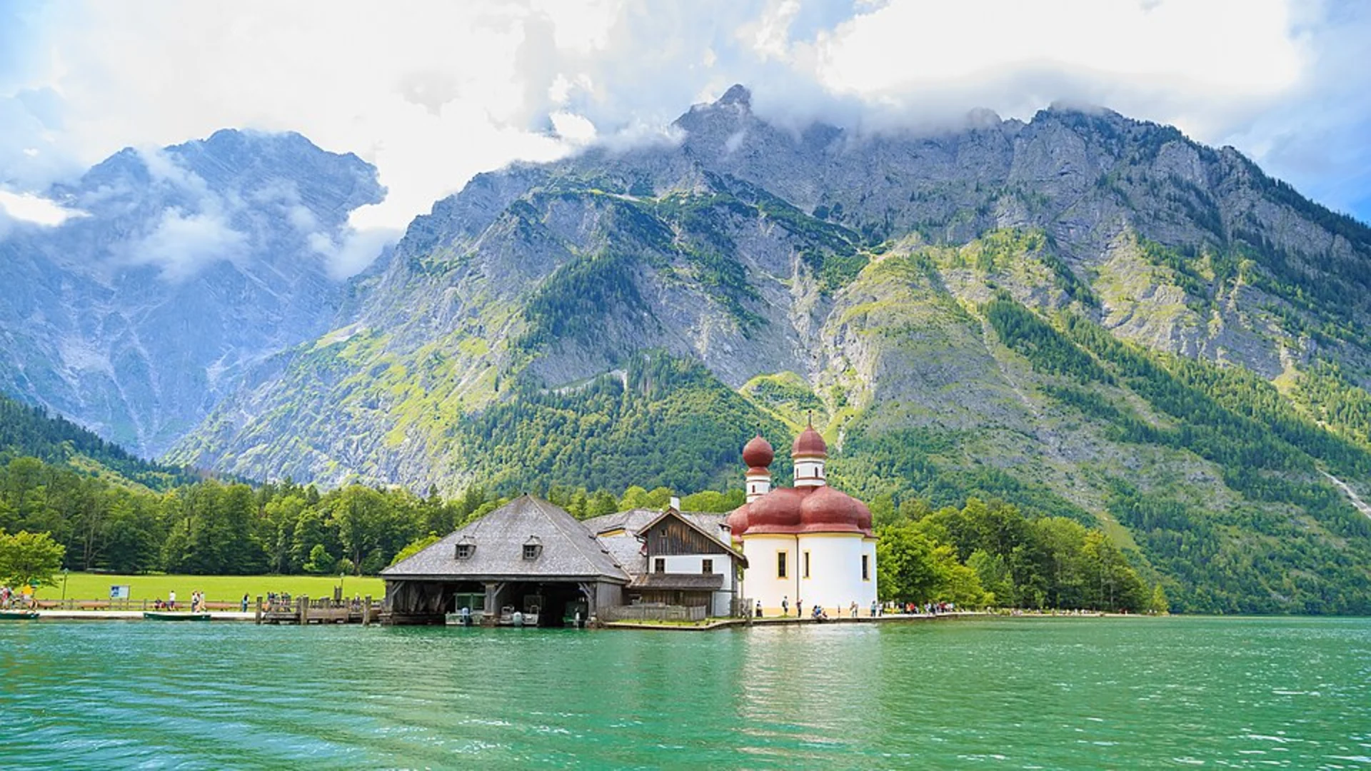
The last 3 kilometers (1.9 miles) involve a descent of about 300 meters (985 feet) towards St Bartholomae. This part of the trail can be slippery, especially after rain, so take care with your footing. As you approach St Bartholomae, you'll be greeted by the iconic red-domed church, a landmark that dates back to the 12th century. The church is situated on the western shore of Königssee and is accessible only by boat or on foot, adding to its secluded charm.
Navigation and Safety
For navigation, it's highly recommended to use the HiiKER app, which provides detailed maps and real-time updates. The trail is generally well-marked, but having a reliable navigation tool can be invaluable, especially in poor weather conditions.
Flora and Fauna
Throughout the hike, you'll encounter a diverse range of flora and fauna. In the lower elevations, expect to see beech and oak trees, while higher up, you'll find spruce and fir. The alpine meadows are home to a variety of wildflowers, including edelweiss and gentian. Birdwatchers will also find plenty to enjoy, with species like the golden eagle and peregrine falcon often spotted soaring above.
Getting Back
Upon reaching St Bartholomae, you can take a boat ride across Königssee back to the village of Schönau am Königssee, where you can catch public transport back to Berchtesgaden. Alternatively, if you have arranged for a car shuttle, you can drive back to your starting point.
This trail offers a mix of challenging terrain, breathtaking views, and historical landmarks, making it a rewarding experience for hikers of all levels.
What to expect?
Activity types
Comments and Reviews
User comments, reviews and discussions about the Berchtesgaden to St Bartholomae via AV Weg, Germany.
4.6
average rating out of 5
5 rating(s)

