12.2 km
~3 hrs 6 min
399 m
“The Muthmannsreuth and Trokau Rundwanderweg offers a scenic 12 km hike through Bavarian beauty and history.”
Starting near the picturesque town of Bayreuth, Germany, the Muthmannsreuth and Trokau Rundwanderweg is a delightful 12 km (7.5 miles) point-to-point trail with an elevation gain of approximately 300 meters (984 feet). This medium-difficulty hike offers a blend of natural beauty, historical landmarks, and charming rural landscapes.
### Getting There To reach the trailhead, you can either drive or use public transport. If driving, head towards Bayreuth and follow signs to Muthmannsreuth. For those using public transport, take a train to Bayreuth Hauptbahnhof. From there, local buses can take you closer to the trailhead, with the nearest stop being in Muthmannsreuth itself.
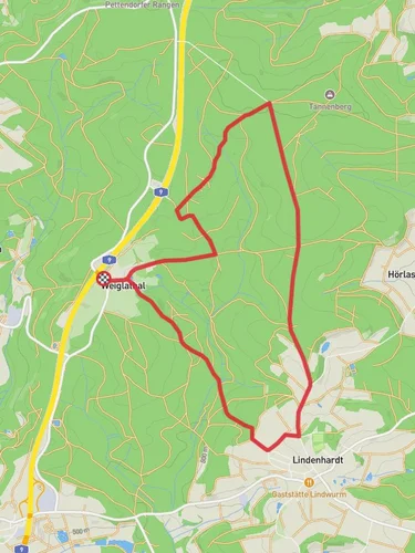
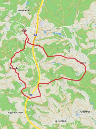
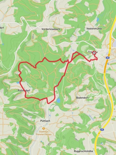
### Trail Overview The trail begins in Muthmannsreuth, a quaint village that sets the tone for the journey ahead. As you start, you'll be greeted by rolling hills and lush meadows. The first 3 km (1.9 miles) are relatively gentle, allowing you to ease into the hike while enjoying the serene countryside.
### Significant Landmarks and Nature Around the 4 km (2.5 miles) mark, you'll come across the historic village of Trokau. This area is known for its traditional Bavarian architecture and offers a glimpse into the region's past. Take a moment to explore the village and perhaps visit a local café for a quick refreshment.
Continuing on, the trail ascends gradually, gaining about 150 meters (492 feet) in elevation over the next 3 km (1.9 miles). This section is particularly scenic, with dense forests and occasional clearings that offer panoramic views of the surrounding landscape. Keep an eye out for local wildlife, including deer and various bird species.
### Historical Significance The region around Bayreuth is steeped in history. Bayreuth itself is famous for its association with composer Richard Wagner, and while the trail doesn't directly pass through the town, the cultural influence is palpable. The villages of Muthmannsreuth and Trokau have their own historical charm, with buildings dating back several centuries.
### Navigation and Safety Given the moderate difficulty of the trail, it's advisable to use a reliable navigation tool like HiiKER to ensure you stay on track. The trail is well-marked, but having a digital map can be incredibly helpful, especially in the more forested sections.
### Final Stretch The last 2 km (1.2 miles) of the trail involve a gentle descent back towards the starting point. This section is less strenuous, allowing you to cool down and reflect on the journey. As you approach the end, you'll pass through more open fields, offering a final opportunity to soak in the natural beauty of the region.
This trail is perfect for those looking to experience the Bavarian countryside, with its mix of natural landscapes and historical villages. Whether you're a seasoned hiker or someone looking for a moderately challenging day hike, the Muthmannsreuth and Trokau Rundwanderweg offers a rewarding experience.

Reviews
User comments, reviews and discussions about the Muthmannsreuth and Trokau Rundwanderweg, Germany.
4.0
average rating out of 5
2 rating(s)