11.3 km
~2 hrs 25 min
105 m
“The Langertalweg Loop is a captivating, moderate 11 km hike through lush forests, historical ruins, and scenic vistas.”
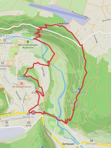
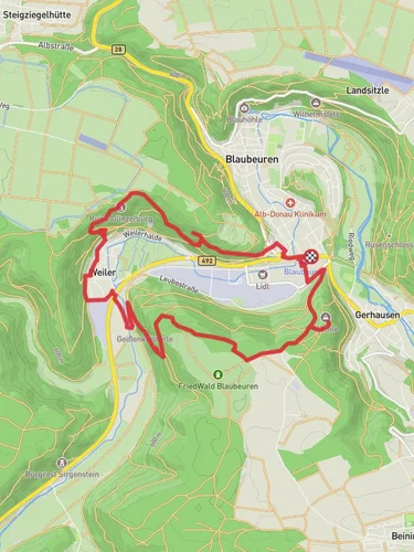
Starting near Alb-Donau-Kreis, Germany, the Langertalweg Loop is a captivating 11 km (approximately 6.8 miles) trail with an elevation gain of around 100 meters (328 feet). This loop trail offers a medium difficulty rating, making it suitable for moderately experienced hikers.
### Getting There To reach the trailhead, you can drive or use public transport. If driving, set your GPS to Alb-Donau-Kreis, Germany, and look for parking near the trailhead. For public transport, take a train to the nearest station in Blaubeuren, and from there, a local bus or taxi can take you to the trailhead.
### Trail Overview The Langertalweg Loop begins with a gentle ascent through lush forests, offering a serene start to your hike. The initial 2 km (1.2 miles) will take you through dense woodlands, where you can enjoy the shade and the sounds of local birdlife. Keep an eye out for deer and other small mammals that are often seen in this area.
### Historical Significance As you progress, you'll come across several historical landmarks. Around the 4 km (2.5 miles) mark, you'll find the ruins of an old mill, a reminder of the region's rich industrial past. This area was once a hub for milling grain, and the ruins offer a glimpse into the lives of those who lived and worked here centuries ago.
### Scenic Views and Landmarks At approximately 6 km (3.7 miles), the trail opens up to a stunning viewpoint overlooking the Langertal Valley. This is a perfect spot to take a break, enjoy a snack, and soak in the panoramic views. The elevation gain here is about 50 meters (164 feet), providing a moderate challenge but rewarding you with breathtaking scenery.
### Flora and Fauna The trail is abundant with diverse flora and fauna. In spring and summer, wildflowers bloom along the path, adding vibrant colors to your hike. The forested sections are home to various bird species, so bringing a pair of binoculars could enhance your experience.
### Navigation For navigation, it's highly recommended to use the HiiKER app, which provides detailed maps and real-time updates. This will ensure you stay on track and can easily find points of interest along the way.
### Final Stretch The last 3 km (1.9 miles) of the trail lead you back through a mix of forest and open meadows. This section is relatively flat, allowing for a leisurely end to your hike. As you approach the trailhead, you'll pass by a small stream, perfect for a quick cool-down before concluding your journey.
### Practical Tips - Wear sturdy hiking boots, as some sections can be rocky and uneven. - Bring enough water and snacks, especially if you plan to take breaks at the scenic viewpoints. - Check the weather forecast before heading out, as the trail can become slippery after rain.
The Langertalweg Loop offers a balanced mix of natural beauty, historical landmarks, and moderate physical challenge, making it a rewarding experience for any hiker.
Reviews
User comments, reviews and discussions about the Langertalweg Loop, Germany.
5.0
average rating out of 5
2 rating(s)


