DAYS
HOURS
MINS
SECS
SALE ENDS SOON!
DISCOUNT ON ALL PRO+ FEATURES
DAYS
HOURS
MINS
SECS
DISCOUNT ON ALL PRO+ FEATURES
5.4 km
1 h 55 m
221 m
“Explore the scenic Pinhaw Beacon via Pennine Way, a 5 km loop offering stunning views and historical intrigue.”
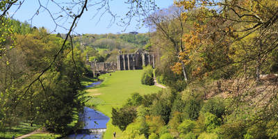
Starting near North Yorkshire, England, the Pinhaw Beacon via Pennine Way trail is a delightful loop that spans approximately 5 km (3.1 miles) with an elevation gain of around 200 meters (656 feet). This medium-difficulty hike offers a blend of natural beauty, historical significance, and a touch of adventure.
### Getting There To reach the trailhead, you can drive or use public transport. If driving, set your GPS to the nearest known address, which is the village of Thornton-in-Craven. There is limited parking available near the village, so arriving early is advisable. For those using public transport, the nearest train station is Skipton, from where you can take a local bus to Thornton-in-Craven.
### Trail Overview The trail begins near Thornton-in-Craven and quickly immerses you in the serene landscapes of North Yorkshire. As you start your ascent, the path is well-marked and relatively easy to follow. However, it’s always a good idea to have a reliable navigation tool like HiiKER to ensure you stay on track.
### Key Landmarks and Points of Interest - Pinhaw Beacon: The highlight of the trail, Pinhaw Beacon, is reached after approximately 2.5 km (1.55 miles) into the hike. This vantage point offers panoramic views of the surrounding countryside, including the Yorkshire Dales and, on a clear day, even the distant peaks of the Lake District. The beacon itself is a historical marker, originally used as a signal point during times of war. - Pennine Way: As part of the famous Pennine Way, this section of the trail is steeped in history. The Pennine Way is one of the oldest and most iconic long-distance footpaths in England, stretching from Derbyshire to the Scottish Borders. Walking this segment gives you a taste of the larger journey. - Wildlife and Flora: The trail is home to a variety of wildlife, including birds of prey like kestrels and buzzards. The flora is equally diverse, with heather moorlands and wildflowers adding splashes of color, especially in the spring and summer months.
### Trail Conditions and What to Expect The trail is generally well-maintained but can be muddy and slippery in sections, particularly after rain. Good hiking boots with ankle support are recommended. The initial ascent to Pinhaw Beacon is the most strenuous part, but the effort is well worth it for the views. After reaching the beacon, the trail loops back, offering a more gradual descent.
### Historical Significance The area around Pinhaw Beacon has a rich history. The beacon itself was part of a network used to warn of invasions during the Napoleonic Wars. Additionally, the Pennine Way, established in 1965, has been a significant route for hikers and has played a crucial role in the conservation of the British countryside.
### Navigation and Safety While the trail is well-marked, carrying a map and compass or using a navigation app like HiiKER is advisable. Weather in this region can be unpredictable, so pack layers and be prepared for sudden changes. Always inform someone of your hiking plans and estimated return time.
This hike offers a rewarding experience with its mix of natural beauty, historical landmarks, and the sense of accomplishment that comes from reaching Pinhaw Beacon. Whether you're a seasoned hiker or a casual walker, this trail provides a memorable adventure in the heart of North Yorkshire.
User comments, reviews and discussions about the Pinhaw Beacon via Pennine Way, England.
0.0
average rating out of 5
0 rating(s)