Middleton in Teesdale to Dover Walk trail stages
stage 1
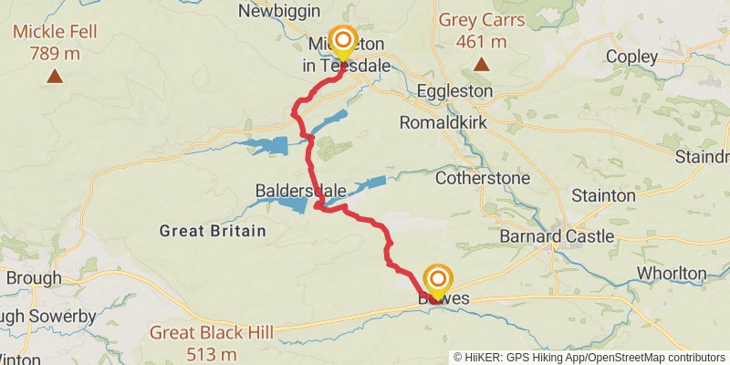
Starting at: Holwick, County Durham, DL12 0PG
Distance: 19.2 km
Elevation gain: 494 m
Duration: 04:40:09
stage 2
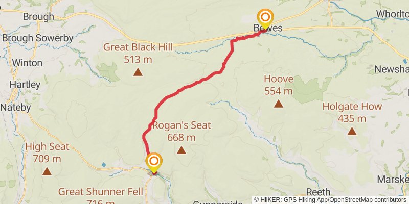
Starting at: Bowes, County Durham, DL12 9LE
Ending at: Keld, North Yorkshire, DL11 6LJ
Distance: 20.1 km
Elevation gain: 369 m
Duration: 04:38:32
stage 3
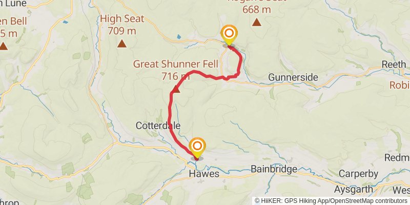
Starting at: Keld, Richmondshire, North Yorkshire, DL11 6LJ
Ending at: Hardraw, Appersett, North Yorkshire, DL8 3LZ
Distance: 17.6 km
Elevation gain: 643 m
Duration: 04:35:12
stage 4
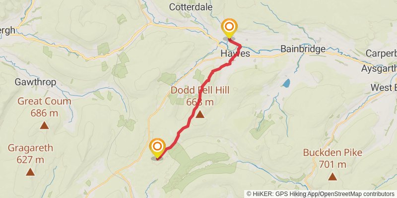
Starting at: Appersett, Richmondshire, North Yorkshire, DL8 3LZ
Distance: 15.1 km
Elevation gain: 483 m
Duration: 03:49:01
stage 5

stage 6
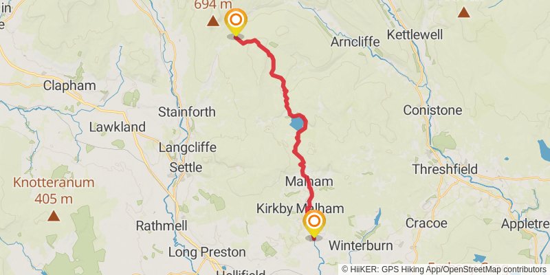
Starting at: Craven, North Yorkshire, BD24 9PW
Ending at: Airton, North Yorkshire, BD23 4AF
Distance: 18.5 km
Elevation gain: 425 m
Duration: 04:24:40
stage 7
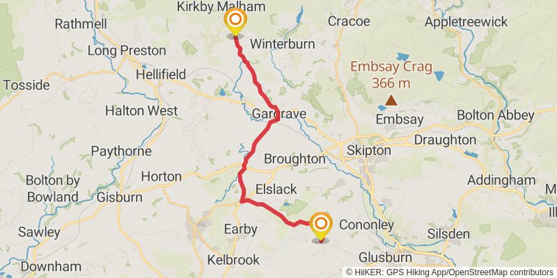
Starting at: Airton, Craven, North Yorkshire, BD23 4AF
Ending at: Lothersdale, North Yorkshire, BD20 8EL
Distance: 20.2 km
Elevation gain: 474 m
Duration: 04:50:20
stage 8
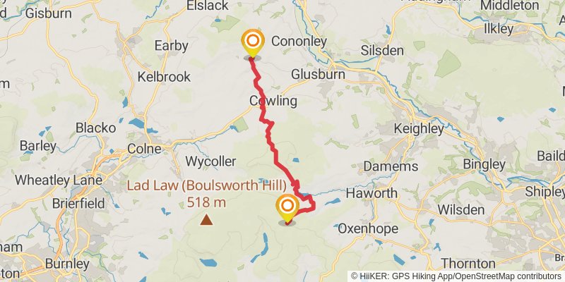
Starting at: Lothersdale, Craven, North Yorkshire, BD20 8EL
Ending at: Top Withins, Bradford, Bradford, BD22 0JW
Distance: 16.2 km
Elevation gain: 677 m
Duration: 04:22:10
stage 9
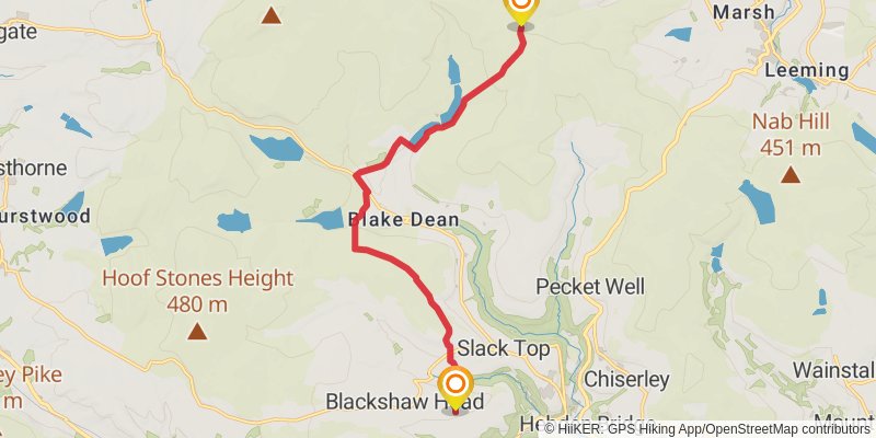
Starting at: Bradford, Bradford, BD22 0JW
Ending at: Calderdale, Calderdale, HX7 7JP
Distance: 11.8 km
Elevation gain: 297 m
Duration: 02:50:52
stage 10
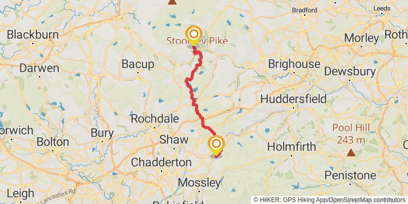
Starting at: Slack Top, Calderdale, Calderdale, HX7 7JP
Ending at: The Diggle Hotel, Oldham, Oldham, OL3 5GH
Distance: 28.1 km
Elevation gain: 664 m
Duration: 06:43:55
stage 11

Starting at: Diggle, Oldham, OL3 5JZ
Ending at: Tameside, Tameside, SK15 3PA
Distance: 17.5 km
Elevation gain: 596 m
Duration: 04:29:25
stage 12
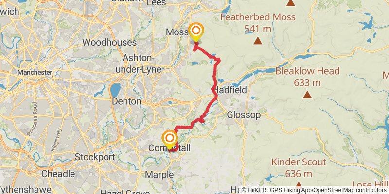
Starting at: Carrbrook, Tameside, Tameside, SK15 3PA
Distance: 17.8 km
Elevation gain: 493 m
Duration: 04:22:48
stage 13
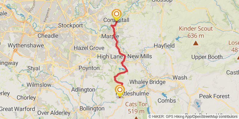
Starting at: Compstall, Stockport, SK6 5HW
Ending at: Rainow, Cheshire East, SK10 5UU
Distance: 16.4 km
Elevation gain: 482 m
Duration: 04:05:07
stage 14
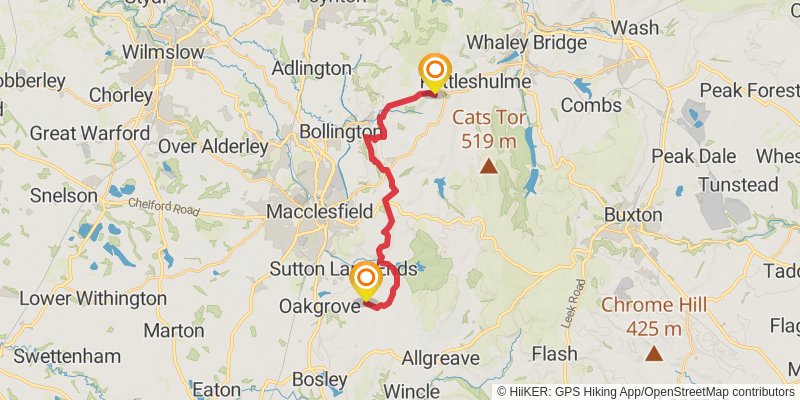
Starting at: Rainow, Cheshire East, SK10 5UU
Ending at: Sutton Lane Ends, Cheshire East, SK11 0LU
Distance: 16.2 km
Elevation gain: 487 m
Duration: 04:02:59
stage 15
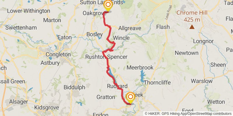
Starting at: Sutton Lane Ends, Cheshire East, SK11 0LU
Distance: 22.1 km
Elevation gain: 493 m
Duration: 05:14:06
stage 16
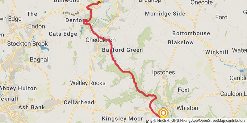
Starting at: Staffordshire Moorlands, Staffordshire, ST13 7AB
Distance: 14.6 km
Elevation gain: 300 m
Duration: 03:25:40
stage 17
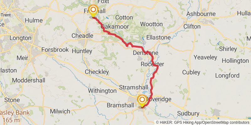
Ending at: East Staffordshire, Staffordshire, ST14 8BP
Distance: 23.2 km
Elevation gain: 362 m
Duration: 05:15:09
stage 18
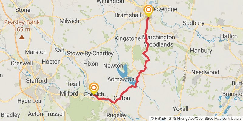
Starting at: East Staffordshire, Staffordshire, ST14 8BT
Ending at: Stafford, Staffordshire, ST17 0XZ
Distance: 22.7 km
Elevation gain: 221 m
Duration: 04:54:31
stage 19
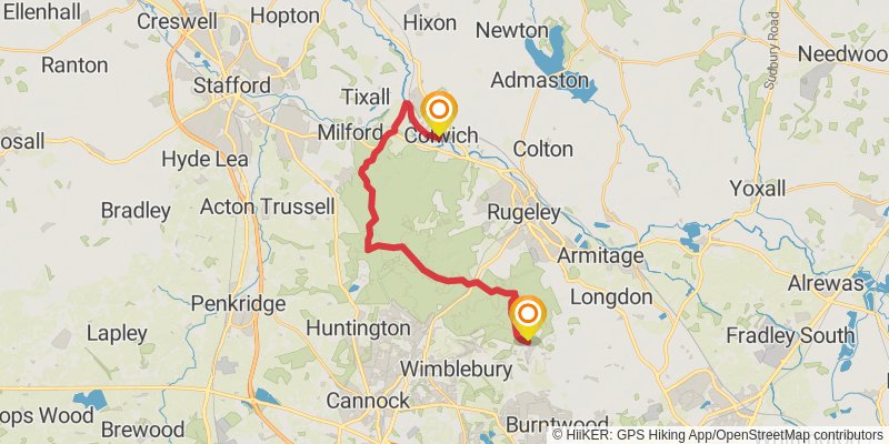
Starting at: Little Haywood, Staffordshire, ST17 0XZ
Distance: 19.2 km
Elevation gain: 422 m
Duration: 04:32:19
stage 20
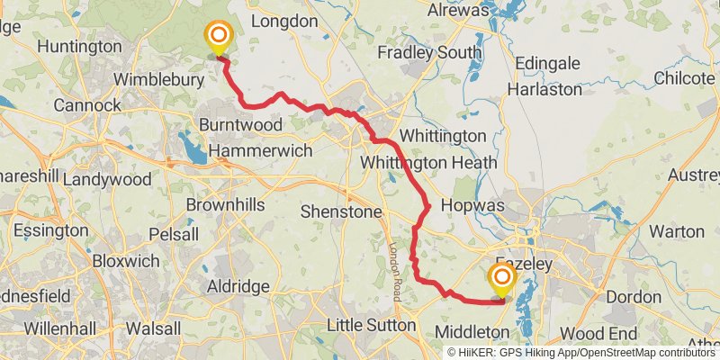
Distance: 26.7 km
Elevation gain: 256 m
Duration: 05:46:28
stage 21
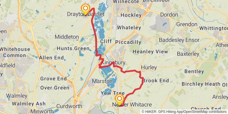
Starting at: Drayton Basset, Staffordshire, B78 3UL
Ending at: North Warwickshire, Warwickshire, B46 2HX
Distance: 15.3 km
Elevation gain: 110 m
Duration: 03:15:00
stage 22
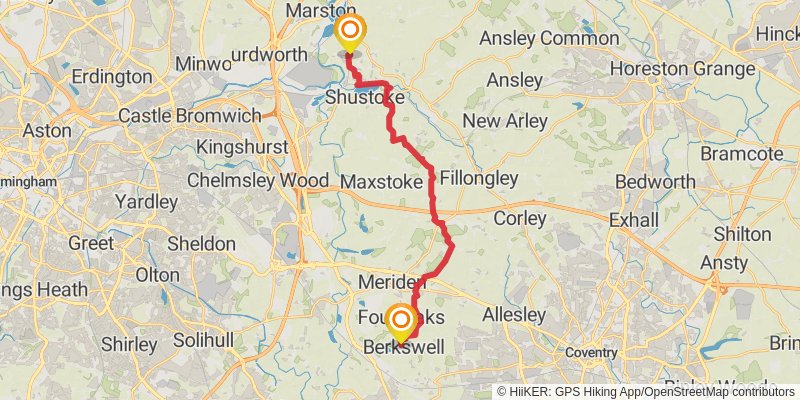
Distance: 20.1 km
Elevation gain: 243 m
Duration: 04:25:23
stage 23
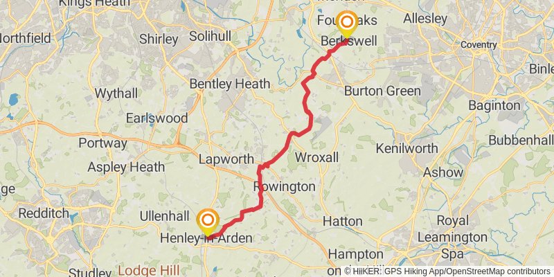
Starting at: Four Oaks, Metropolitan Borough of Solihull, CV7 7BE
Distance: 21.4 km
Elevation gain: 222 m
Duration: 04:39:26
stage 24
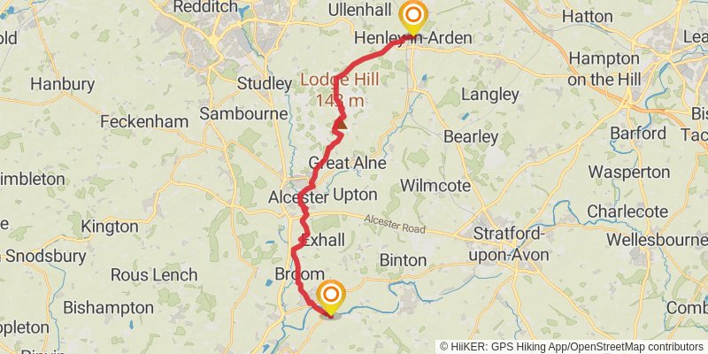
Starting at: Stratford-on-Avon, Warwickshire, B95 5AZ
Distance: 21.7 km
Elevation gain: 251 m
Duration: 04:45:26
stage 25
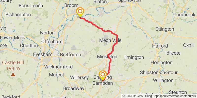
Distance: 20.3 km
Elevation gain: 256 m
Duration: 04:28:57
stage 26
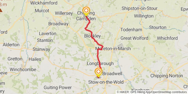
Starting at: Broad Campden, Cotswold, Gloucestershire, GL55 6DA
Distance: 17.6 km
Elevation gain: 409 m
Duration: 04:12:14
stage 27
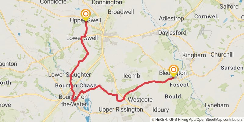
Starting at: Upper Swell, Cotswold, Gloucestershire, GL54 1EW
Ending at: Cotswold, Gloucestershire, OX7 6XD
Distance: 17.7 km
Elevation gain: 187 m
Duration: 03:51:17
stage 28

Starting at: Bledington, Cotswold, Gloucestershire, OX7 6XD
Ending at: West Oxfordshire, Oxfordshire, OX29 8PT
Distance: 21.9 km
Elevation gain: 196 m
Duration: 04:42:46
stage 29
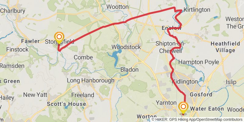
Starting at: Stonesfield, West Oxfordshire, Oxfordshire, OX29 8PR
Ending at: Cherwell, Oxfordshire, OX5 1GD
Distance: 22.3 km
Elevation gain: 137 m
Duration: 04:41:05
stage 30
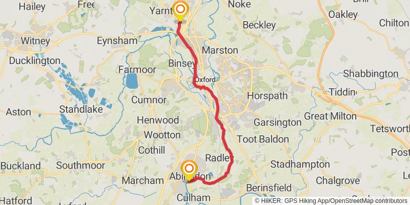
Starting at: Yarnton, Cherwell, Oxfordshire, OX5 1GD
Ending at: Vale of White Horse, Oxfordshire, OX14 3HY
Distance: 21.7 km
Elevation gain: 79 m
Duration: 04:28:18