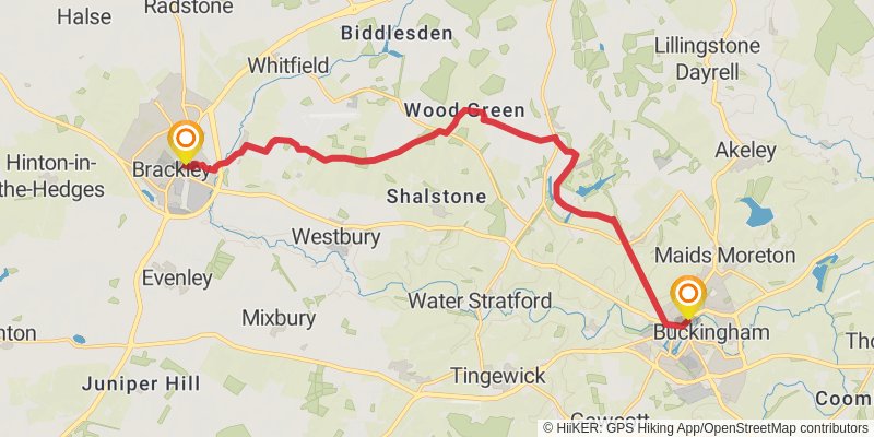
Palladian Way trail stages
stage 1

Starting at: Page Hill, Buckinghamshire, MK18 1JN
Ending at: Brackley, West Northamptonshire, NN13 7BW
Distance: 15.6 km
Elevation gain: 199 m
Duration: 03:27:33
stage 2

Starting at: West Northamptonshire, NN13 7NR
Ending at: Cherwell, Oxfordshire, OX25 4AD
Distance: 19.8 km
Elevation gain: 126 m
Duration: 04:09:47
stage 3

Starting at: Middleton Stoney, Cherwell, Oxfordshire, OX25 4AN
Ending at: West Oxfordshire, Oxfordshire, OX20 1TS
Distance: 17.2 km
Elevation gain: 126 m
Duration: 03:39:21
stage 4

Starting at: West Oxfordshire, Oxfordshire, OX20 1TG
Distance: 23.7 km
Elevation gain: 269 m
Duration: 05:11:16
stage 5

Starting at: Swinbrook, West Oxfordshire, Oxfordshire, OX18 4HW
Ending at: Cotswold, Gloucestershire, GL7 5AL
Distance: 20.7 km
Elevation gain: 196 m
Duration: 04:27:55
stage 6

Starting at: Coln St Aldwyns, Cotswold, Gloucestershire, GL7 5AL
Distance: 24.4 km
Elevation gain: 255 m
Duration: 05:18:48
stage 7

Starting at: Chesterton, Cotswold, Gloucestershire, GL7 1QR
Ending at: Milbourne, Wiltshire, SN16 0BY
Distance: 25.0 km
Elevation gain: 214 m
Duration: 05:21:29
stage 8

Starting at: Milbourne, Wiltshire, SN16 0BY
Distance: 17.3 km
Elevation gain: 158 m
Duration: 03:43:18
stage 9

Starting at: Upper Castle Combe, Wiltshire, SN14 7EZ
Ending at: St Thomas a Becket, Box, Wiltshire, SN13 8DT
Distance: 11.6 km
Elevation gain: 252 m
Duration: 02:43:54
stage 10

Starting at: Box, Wiltshire, SN13 8DT
Ending at: Bath, Bath and North East Somerset, BA2 4AY
Distance: 17.1 km
Elevation gain: 409 m
Duration: 04:06:37