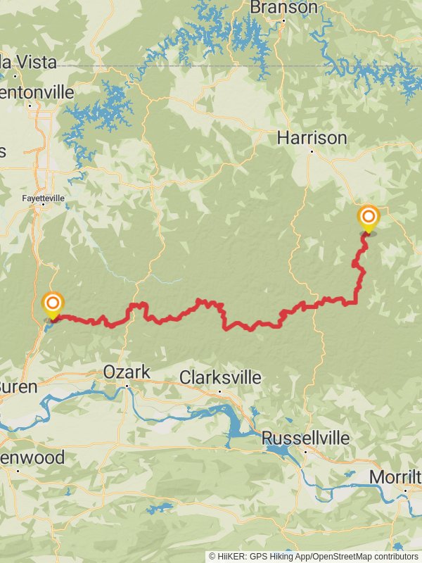
Ozark Highlands Trail
Ozark-St. Francis National Forest · Crawford County, Arkansas
246.5 km
~11 day
5878 m
“Embark on the Ozark Highlands Trail, a journey of breathtaking vistas, diverse wildlife, and rich history through Arkansas's heart.”
Spanning approximately 246 kilometers (153 miles) through the Ozark National Forest, the Ozark Highlands Trail offers an immersive experience into the rugged beauty of the Arkansas wilderness. With an elevation gain of around 5800 meters (19,000 feet), hikers can expect a challenging yet rewarding journey through rolling hills, lush forests, and serene streams.
Getting to the Trailhead
The trailhead is located near Lake Fort Smith State Park in Crawford County, Arkansas. For those driving, the park is accessible via Interstate 49, taking exit 29 to Highway 71, which leads directly to the park entrance. Public transportation options are limited, but hikers can reach nearby cities such as Fayetteville or Fort Smith by bus and then arrange for a taxi or rideshare to the trailhead.
Navigating the Trail
Hikers can rely on the HiiKER app for detailed maps and navigation assistance throughout the trail. It's advisable to download the maps for offline use, as cell service can be spotty in the remote areas of the Ozark National Forest.
Landmarks and Scenery
The trail is marked by a series of notable landmarks and natural features. Within the first few miles, hikers will encounter the picturesque Lake Fort Smith, a perfect spot for a rest or photo opportunity. As the trail meanders northeast, it passes through several wilderness areas, each with its own unique landscape.
Wildlife and Flora
The Ozark Highlands Trail is home to a diverse array of wildlife, including white-tailed deer, black bears, and numerous bird species. The flora is equally varied, with hardwood forests giving way to pine groves and occasional glades. Springtime hikers will be greeted by a colorful display of wildflowers, including the delicate dogwood and redbud trees.
Historical Significance
The Ozarks are steeped in history, with the trail itself crossing paths with remnants of old homesteads, moonshine stills, and Native American sites. The region was a contested territory during the Civil War, and hikers may stumble upon old military roads and historical markers recounting the area's past.
Trail Sections and Difficulty
The trail is divided into several sections, each with its own character and difficulty level. The first section from Lake Fort Smith to Ozone is known for its moderate climbs and well-maintained paths. As the trail progresses, the terrain becomes more challenging, with steeper ascents and descents, particularly in the section leading up to the Hurricane Creek Wilderness.
Preparation and Safety
Hikers should be well-prepared with adequate supplies, including water, food, and appropriate gear for changing weather conditions. It's important to inform someone of your itinerary and expected return time. Bear safety precautions should be taken seriously, including the use of bear-proof containers for food storage.
Seasonal Considerations
The best times to hike the Ozark Highlands Trail are spring and fall when temperatures are mild, and the foliage is either blooming or showcasing vibrant autumn colors. Summer hikes are possible but can be hot and humid, while winter brings its own challenges with potential snow and ice.
End of the Trail
The eastern terminus of the trail is at Woolum, a remote area near the Buffalo National River. From here, hikers can arrange for pick-up or continue their adventure by exploring the Buffalo River trails or heading into the nearby town of St. Joe for well-deserved rest and replenishment.
Reviews
User comments, reviews and discussions about the Ozark Highlands Trail, Arkansas.
5.0
average rating out of 5
21 rating(s)


